
When I started my Patreon 5 years ago my goal was to try and do Greyhawk content, giving it away under a Creative Commons license, to be an asset to Greyhawk fans. A huge thank you to those of you who have supported me during this time, and a warm welcome to all those who have joined recently!
This Summer Update will be a bit lengthy as I will try and go over all the things I’m currently working on and what I plan to get started soon.
Heraldry
I’ve created my take on existing Greyhawk heraldry, and created a lot of new heraldry, over 400 all in all. What started out as an experiment turned out to be a lot of fun, and very popular. I like to do heraldry, they are neat little projects to dig into for an hour or tow every other day, and they are very popular.
My latest experiment in this field is simple shields. It was an idea by Michael Mossbarger to create shields used not by the kings, lord and generals, but by the common foot soldier. I did a couple of simple wooden shields on my last livestream. It was fun and might be useful, what do you think?
A Greyhawk peasant militia soldiers’ shield.

And one from Dyvers

There will be more shields, I’m creating them as I read, and re-read Greyhawk lore, and create for my own campaign. Furyondy, Horned Society Iuz are in focus now. But I’m also going through the history and development of the Great Kingdom and its successor states for a reboot of my Rel Deven campaign. Haven’t run an elven focused campaign in decades, so now I’m also prepping ideas for one in a couple of years. A lot of very interesting possibilities, and thanks to their lifespan it will tie into a lot of history.
New Website
This is a sore thumb of mine; my web presence is not up to the job of being a place where it is easy to find my content. The problem is two-sided, there is so much stuff hidden in a myriad of posts, and the ability to effectively search and find stuff is limited. Setting up and running a website is quite an operation, which thankfully has tools to help you do that. My problem is that most tools seem to be focused on blogs and similar sites, not large content repositories.
The most promising solution I’ve seen, and used a bit is Notion, which now has launched a web publishing function. I’m going to try it out and see if it works for what I need it to do. WordPress is way to much work to change something, it takes me a week or so every time I’m doing a site update more than posting. I want to be able to add pages, change layout, add whole sections to my website without having to take a week or two off to do it. I also don’t have to money to pay someone to do it, and this is where I want control, meaning I need to understand how to do things so I’m not reliant on others.
If any of you know of a powerful and flexible tool to create and manage websites that isn’t too pricy, I’m very interested to hear about it!

As piggyback on my GIS project, I’m going to do what I should have done a long time ago, properly reference all the places and names on my map. All the renewed interest in Greyhawk has made this extra important. Help with this is very much appreciated, since it is a huge undertaking. Greyhawk wikis and similar resources have made this easier, but it is still a lot of work. Before the collection and curation of data begins, we need to define what data we need and the technical details like data formats, files etc. This can start when the GIS data entry is done this fall.
GIS

My project to create a new version of my existing Flanaess Hepmonaland map using GIS is going well. It is a huge undertaking, and after about a year of data entry a first version is in sight later this year.
A New Generation Maps

My current Flanaess Hepmonaland map is getting, while still useful, showing its age being created using tools from the 1990’s. From the Southlands and Midgard maps I did almost a decade ago for Kobold Press to my latest commission, they are created using tools that are decades more advanced. I made a facelift to my current map when I added Hepmonaland some years ago, but it is only so much you can do with a new set of superficial edits.
The GIS conversion will be the last major version of my Flanaess map that will be based on the old stuff. Future maps will be made using tools like GAEA, world Machine and others put together using GIS, Game Engines and of course still rely on editing tools like Photoshop.
For my Shield Lands campaign, I ambitiously set out to map it in “Porta Potty Scale” at 5ft pixel. Due to World Machine 4 no longer supporting tiled imports that I relied on for this I had to rethink my approach. Now a year later I’m having a new approach that can circumvent the issue and still deliver the detail and quality I crave. The result will be the same and, in some ways, even better, but the process is kind of the opposite. Before I work from the bottom up, now it will be more top down – start with the big and then zoom in for details. I thought you would lose quality and that it would be more difficult going top down, that is why I started with bottom up. Now that I’ve tested both methods, I found out I was partially wrong. Thankfully top down can deliver really good quality even faster, and my drainage issues are less common this way.

The new set of maps I’m working on will have a resolution of 150 ft per pixel and cover an area of 450 x 450 miles whit proper waterflow with lakes and rivers in this area. This is with my current tool World Machine 3, which is now old and but still my go to. With WM3 I can do 16K terrains in a single render without tiling. This is the worst-case scenario, WM3 will be the tool to rely on for remapping the Flanaess. It can be done in a few years, and with areas of special interest like cities at 5ft. per pixel special maps as well.

Thankfully there is a new tool coming in Gaea 2, that has been in alpha for a few months and is very promising. If it can deliver what is on its roadmap for later this year, I will be able to go from 16K maps to 256K, over 2 million pixels per side renders. And Gaea is not the only tool on the horizon, terrain creation is going from an obscure thing to a major feature. What is driving this is the new generation game engines, and GIS tools that made it possible to work with whole planets in glorious, detailed 3D. This is driving a demand for better tools to create them, and now we have the hardware to handle them, so the future is looking bright in this field and we as gamers can cash in and make good use of it.

Maps and heraldry have been a great inroad to local and more detailed worldbuilding, which has made me go back and re-read a lot of the old material and have a new look at it. It has given me a lot of new ideas and different takes on things. To better separate my own version from the “standard” Greyhawk map and other stuff I do, I hope it can be useful to label it MeyerHawk so those that are not that into my stuff can avoid it, and the other way around.
Now with over 20 years of experience creating maps, and 40 years gaming in Greyhawk, I feel I’m skilled enough to not only map the setting, but also contribute to it in other ways as well. My goal with the MeyerHawk label is to is to signal that this is my take on the setting, and to provide a rich a deep set of lore for Greyhawk gamers, and others to use. It will be Creative Commons as well, so it can be used, tweaked and shared by Greyhawk fans everywhere.
House Rules
The fluff is taken care of under the MeyerHawk label, how about the crunch!? I’ve been working on a house rule project since before the pandemic, when I started to regularly run games virtually and realized that I needed a firmer grounding rule wise. Somehow when you are forced to interact using computers and video calls written rules and structure becomes more apparent and need to be clearer.
Having started out with AD&D1E/2E, then moved to D&D3E and 3.5. Even 4E for a few months before switching to PF1 and then PF2 to ending up with a sort of 5E-A5E mishmash, just making a few house rules was not going to cut it. I needed a proper set of rules that suited my playstyle, so I looked at almost every fantasy TTRPG rule set, that was at least vaguely related to D&D (and a few others as well). Found a lot of things I liked, but not in the same system. It dawned on me that when I didn’t find the map I needed, I set out to create it. Now I’m in the same situation when it comes to the rules I need for my games, so under the name of a house rule project a whole new TTRPG rule set is taking shape.

This is my working title; we will see if it survives. The goal for this project is to create a rules system that support and facilitate heavy sandbox-style games. It should do its job and then get out of the way, medium crunch and lots of possibilities and support flavor. I’m making a rule set I need, and then we will see what happens, but I want to offer it free for everyone to use. I’m trying to make it easy to learn and hard to impossible master, making long term campaigns viable.
A few holy cows must go to slaughter for Hawk Tales, and that might upset some, but I did it on the altar of my sandbox gaming temple. For example, Armor and AC are overlapping but not the same thing anymore, and Armor softens the blows. Even the mightiest warrior who can face a dragon has a reason to be a little bit wary every time he faces a crowd of commoners.
Another feature is that weapons get deadlier the better you are at using them. A master of daggers can do more damage than a newbie using a greatsword. Big heavy weapons like mauls and greatswords have their advantages but are not the only way to bring down your opponent.
Tactics and crunch are a side of a rules systems that can become too dominant, and you can have lots of cool ideas and the urge is to implement them all. I’m now in the very important phase of trying to streamline and bring better order to things. The goal is to have a system that is easy to understand, but still, it should be able to deliver lots if flavorful outcomes.
The main way Hawk Tales FRP will be different from D&D (and most other fantasy RPG’s) is the main approach in its design. They seem to be based on gameplay, with the rules and its concepts being at the center of the game. Class being such a key concept, it’s a core function of the game and most of the rules are built around it.
My approach is to see the rules as a supporting role in the overall experience. The rules should provide a supportive framework for worldbuilding, gameplay and character progression. I want a world full of people, creatures, magic, epic worlds and exiting adventures, so I want to create a rules structure that support that. A “thief” is a job description, not a set of mechanics. Some thieves would be stealthy and act in the shadows, others would be brutes using intimidation and violence for their illicit activities, or a combination of the two.
Character progression in Hawk Tales FRP will be guided by the desires of the player, which can vary over the career of the character, and what happens during gameplay. What your character does will to a large degree determine what it will get good at, but there is still room for going on a quest to learn magic even if there is no wizard at hand to teach you. It will just be somewhat more difficult and take more time. Character development, combat and what happens during encounters are a side of the gaming experience that most rule sets focus on and handle well. I intend to make my rules able to keep up with the others, but it is hard to improve on what has already been perfected over decades by way more accomplished game designers that amateur me. The side where I think I can provide the biggest incentive for considering adopting Hawk Tales will be on the Game Mastering side of things.
Like with cartography where I used skills learned in other areas and used them to make setting maps, then it was my understanding navigation and what the world looks like that I relied on. This time I am relying on my understanding of things from physics, electronics, politics and how the world works. How could a medieval-like world with magic, dragons, undead and worse function and still make it fun and interesting to delve into and interact with.
For me it is equally important to have a system for high level magic and a way to play out high stakes power struggles as well as the daggers, swords and magic fights. How do you bring down an evil ruler, or even a god. What can necromancers really do with their power, and what would someone get from serving a demon lord. These are questions I want a set of rules to help answer, not by providing all the exact details, that is up to you and your campaign. The key for me is to provide the imaginary arena and guidelines for how to conduct the play.
Things like how are divine beings created and how they gain and wield their power. In this I’ve even managed to revive the concept of alignment languages, and how does Vecna’s gathering of secrets work, and where is Tharizdun imprisoned. These are all campaign plots that Hawk Tales can help you run campaign around and provides rules and guidelines for fighting cults, liches and more, way beyond the simple statblock.
I will run games using an early form of Hawk Tales at Virtual Gary Con 5, GameHole Con and PAGE 2025 and Gary Con XVII, as well as run online short skirmish play tests starting this fall. I hope you might be interested in joining.
A “Skirmish Alpha” Release will be available this fall, that will cover basic rules, encounters, combat and spellcasting. Come with a sample of characters, some opponents to fight and a list of spells and equipment. Hopefully enough for you to see if it is something for you to even consider.

Hawk Tales FRP will be published using Creative Common 4.0 -by license in PDF and Markdown formats and will be available to be downloaded and referenced for free on my website.
The CC -by license makes it possible foe anyone to use, alter and share Hawk Tales as they like. In the day of gatekeeping and corporatization of I want to do what I can to help and inspire gamers to have fun, create and share.
Again, thank you Everyone for making it possible for me to work on this, it is your support that pay for my computers, software and covers the bills so I can spend time work on this!!!
I hope you all feel welcome and are exited to join me in exploring and mapping our favorite fantasy world!

Can't resists this! Awesome creators and a very interesting approach, and for a gamer like me an irresistible aura of attractiveness... 

https://www.kickstarter.com/projects/darkageoftheer/progcore-fantasy-the-dark-age-of-theer
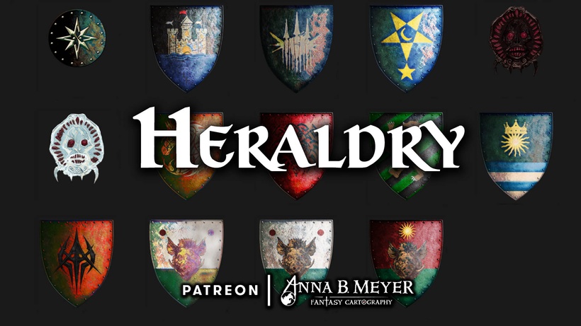
This last batch is a small mixed lot of shields and symbols.
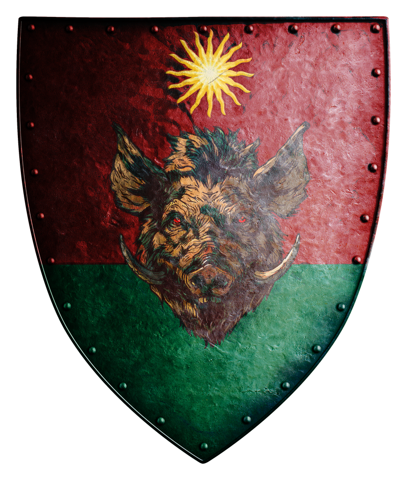
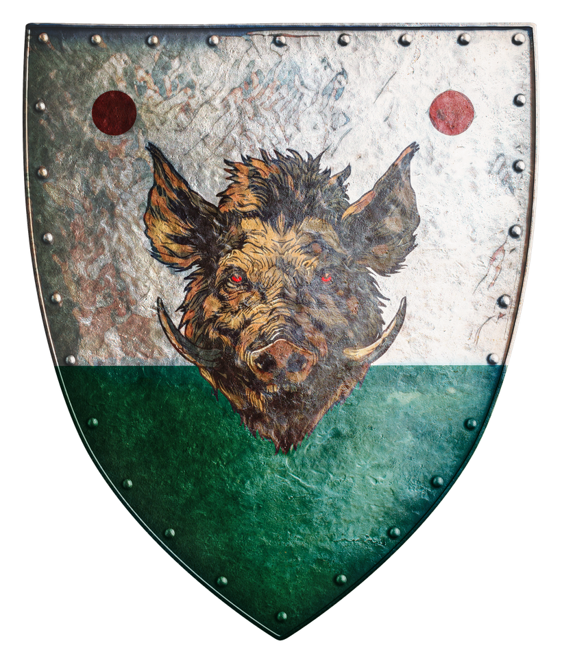 Let’s start with Uskedge that comes from a reference in the Saga of Old City Gord novel, a General Lomor, the Margrave of Uskedge leads a Great Kingdom force into the battle at Woodford in the Adri. I created the March of Uskedge on the North Province/Kingdoms western edge where Woodford is located, and here comes my take on lord Lomor’s shield.
The background of the shield tops with the overkings colors and markings, showing the Margrave is an overking loyal and appointee. The green lower bit is the Edgefield Green, showing Lomor’s family ties and origins. The boar is a symbol Lomor choose to underline his abilities as a hunter, the frontier status and danger of his posting and a way to look cool.
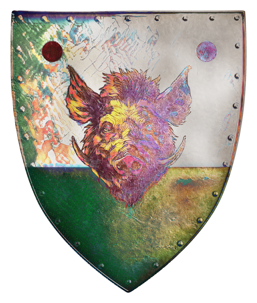
This is the version that was used by Lomor until the fall of Ivid’s line. Above it is shown in an aged version that could be found in the 590’s.
The fall of Ivid forced Lomor to change his allegiance and update hi heraldry accordingly. Gone are the colors of the Overking replaced with the Naelax Red and an Aerdy small star have been added as a way to show allegiance.
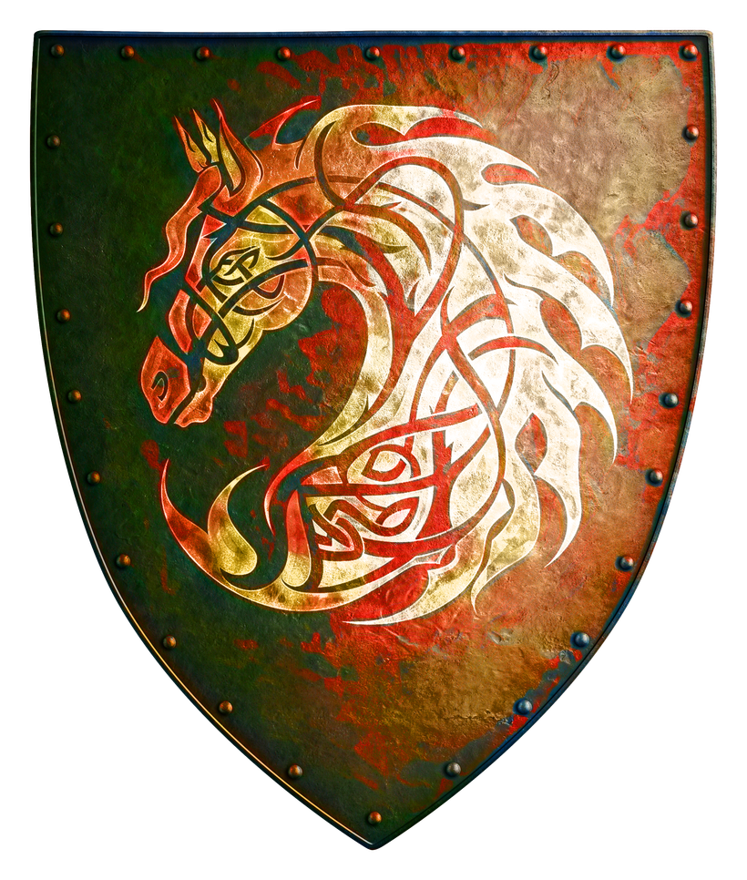
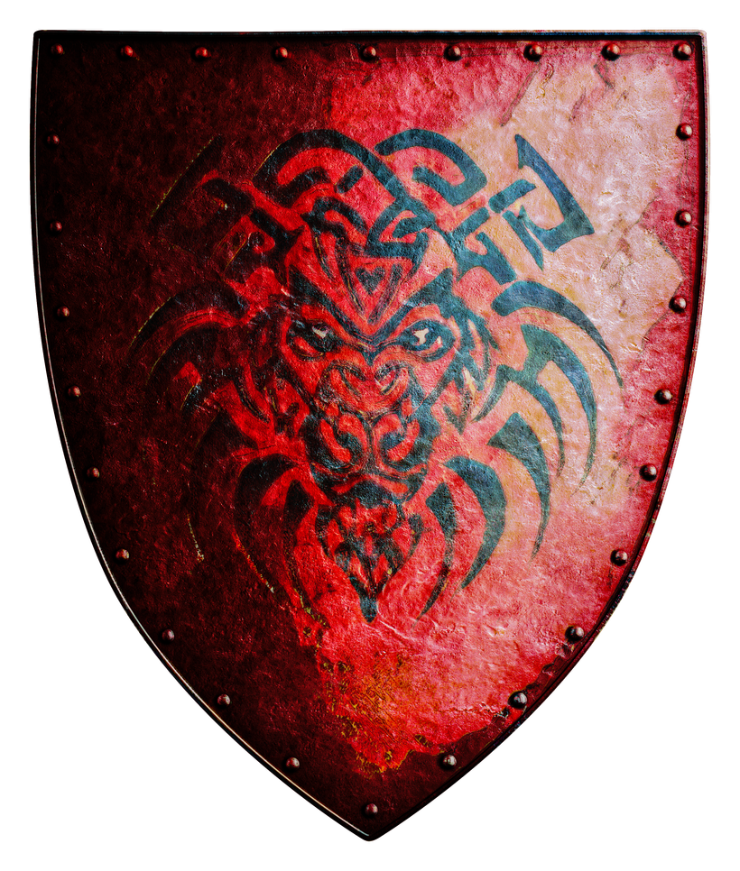
The overking himself kept a retinue of Fiend-Knights, both infantry and cavalry. Their heraldry is described in Ivid the undying as a fierce tan horse and a baboon respectively. I used AI to create the concepts and then used my Photoshop editing chops to create the shields. I placed the symbols on the Naelax red, and due to simulated wear and tare the colors faded a bit differently.
Next up is a variant of the Hardby heraldry from OJ #10 and a design by James A. S. Muldowney.
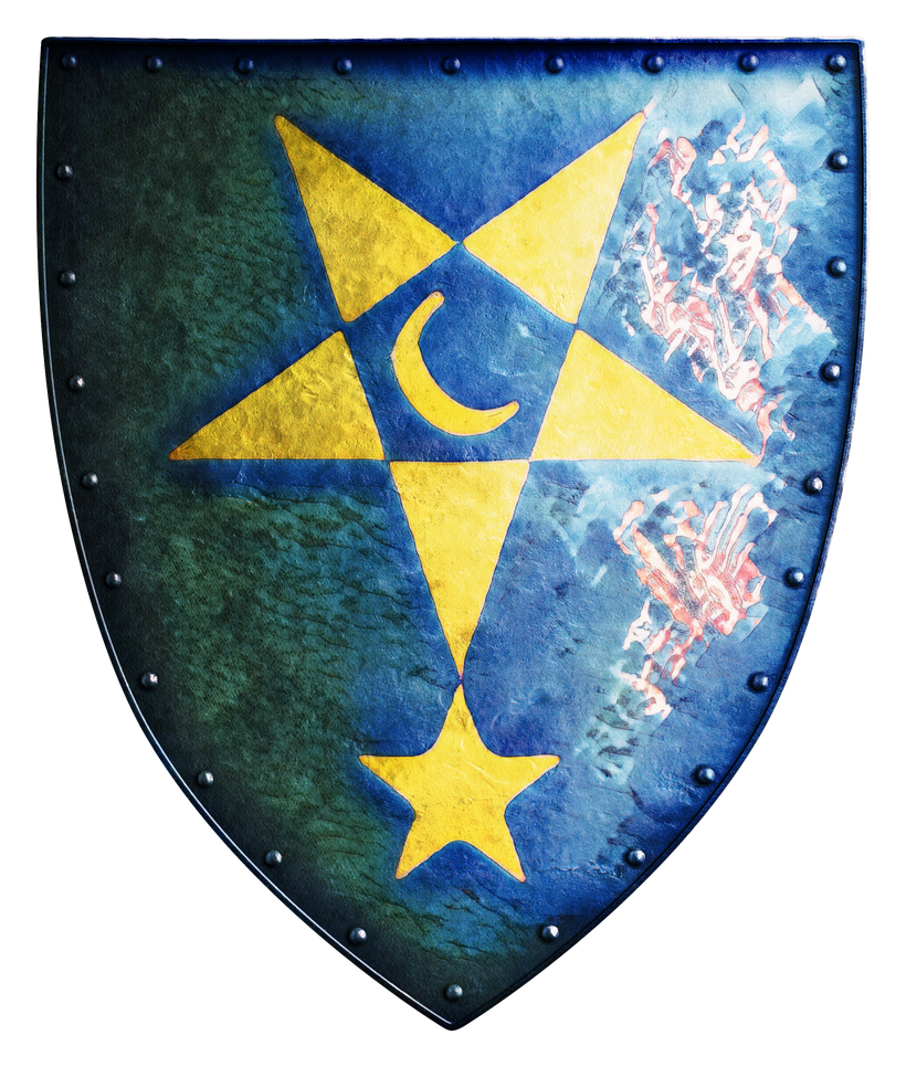
This can be the Hardby shield is you prefer, or it can be one sed by an earlier Gynarch, one competing for power. The moon suggests elven connections…
There is one place in the Empire of Iuz that have managed to retain a “decent” civilized form of heraldry and that is Delaquenn, the town on the eastern shores of the Whyestil.
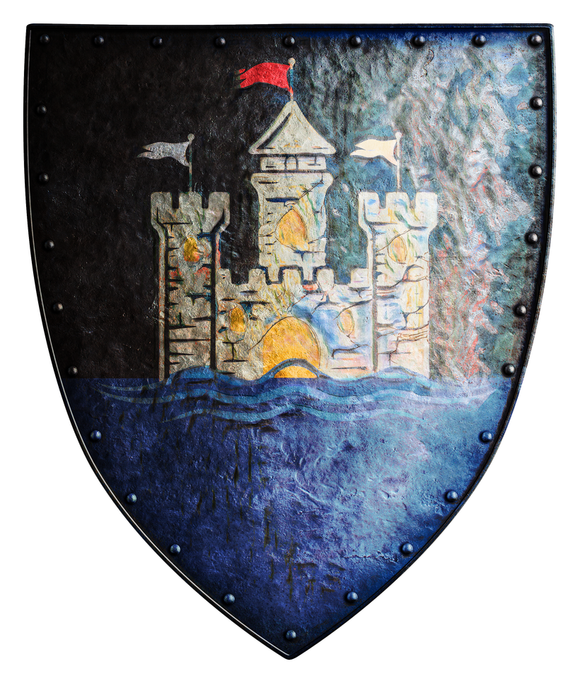
The town was founded by Oeridian explorers with ambitions to become part of the expanding Great Kingdom and the heraldry was made to prove it. The standard Aerdy symbol of city with the black of the then ruling Cranden overking’s house over blue water. The city gate and its windows are gleaming golden to indicate wealth and prosperity. The flags on tops of the towers are probably a later edition showing the colors of Molag.
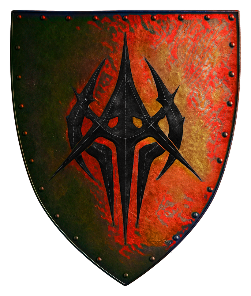
The Keep of Trystenn is a hideous keep along the road between Molag and Dorakaa, ruling the Long March. Its crest is an equally gloomy addition to the annals of heraldry. Based on an Aerdy heater shield to mock the enemy, and with a symbol that is both a homage to the caltrops surrounding the keep, the helmets worn by its guards and their long shafted axes.
While up in the north let’s look at a shield that never was, but could have been, the Northern MarchesThe Great Kingdom’s reach never really got to Blackmoor but it was in their sights. If they had properly conquered it they would probably have made it into the Northern Marches. The name is also an homage to the Northern Marches that was Dave Arneson’s realm in the Great Kingdom campaign.
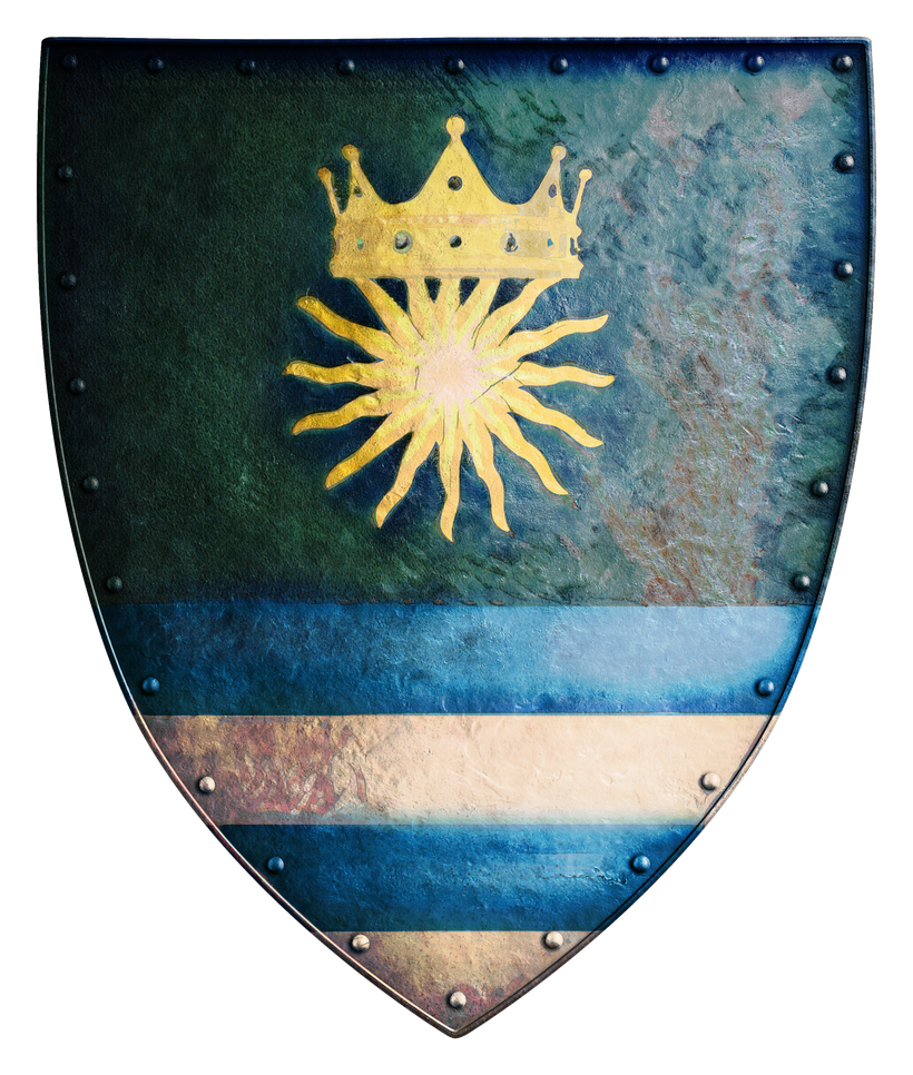
The design is the norm for Aerdy marchlands, the Aerdy seal with the sun and the crown, on a black Cranden background due to the ruling dynasty of Rauxes. At the bottom are the Blackmoor blue and white.
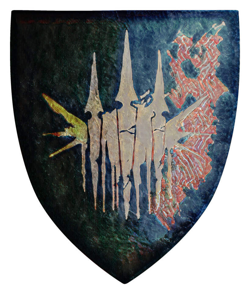
In the Griff Mountains south of Stonehold lies Garel Enkdal, a nest of Orcs (and maybe other humanoids as well). Here is my take on their shield, a portrait of what they are very proud of, their defenses that have held the pesky Fists away for a long time.
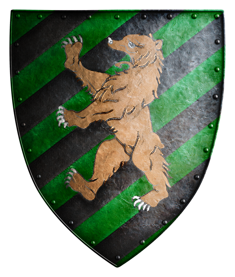
Last of the proper shields are a design I found in the D&D gazetteer, published in 2000. It is in a picture of Belissica and Karll in front of their heraldry, but the Duch one with the bear has black diagonal stripes instead of a uniform background color. I took this design and made it into Duke Karll’s crest and the symbol of his capital Leukish.
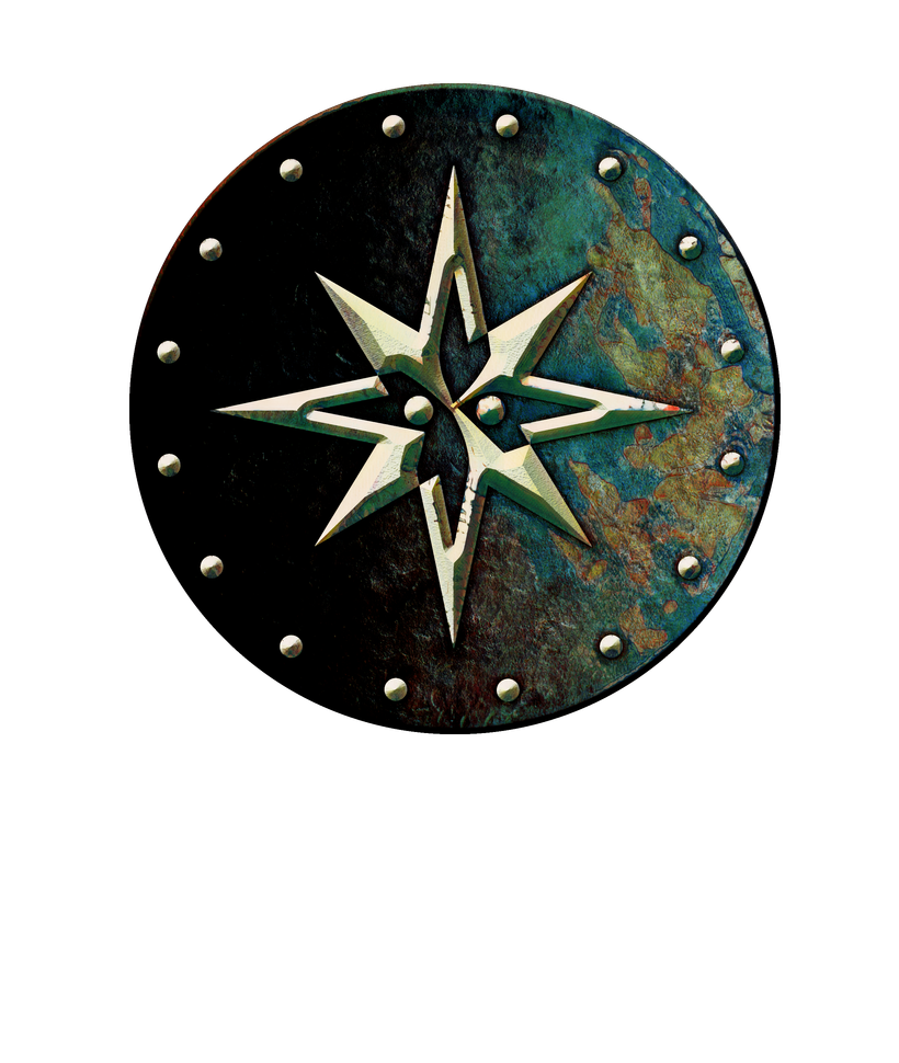
Next up are some other symbols. First out is the Cranden conclave, mentioned in Ivid the Undying. It is usually found as a pin that can be worn on clothes to identify the wearer as a Cranden noble.
Iuz distributes holy symbols to his clergy in two variants, black and white.
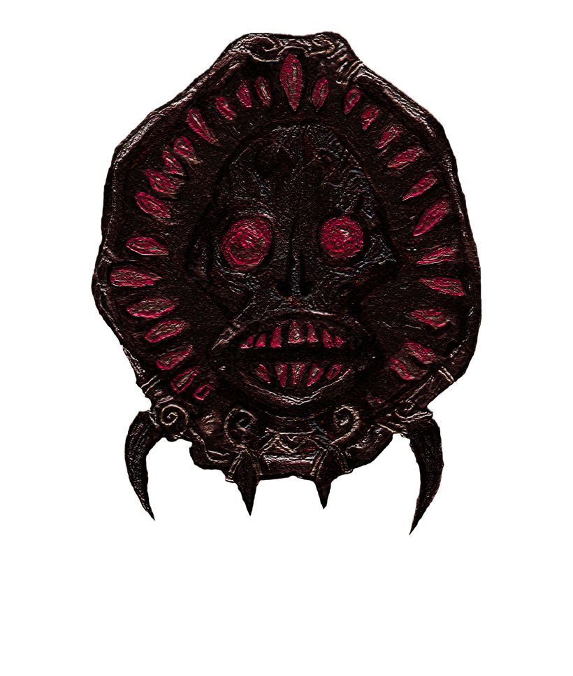
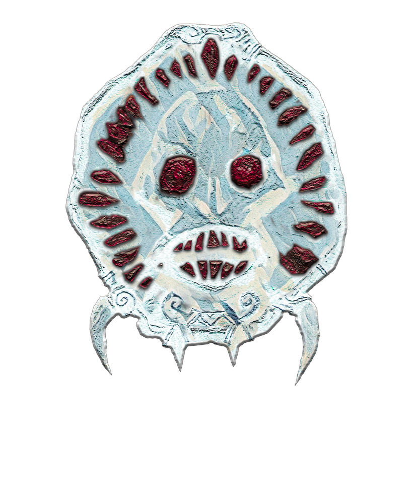
They both work as holy symbols, the reason for having two colors is the same as tyrants throughout history have figured out. Never trust your underlings, so make sure you divide them into competing teams. In case there is a rebellion, Iuz can cancel the power of whatever offending color the hapless instigator was issued with. Might also be only a rumor used to scare lowly henchmen into submission. There are rumors of a red version distributed to the truly powerful among his followings.
https://annabmeyer.com/Downloads/Heraldry/heraldry%2012.zip
all of this is Creative Commons 4.0 -by -nc -sa content!
Maps of the Flanaess over the years
The new Dungeon Masters guide is going to include a poster map with a map of the Flanaess on one side and a map of he City of Greyhawk on the other. A teaser for the new map was just revealed, and it’s made by Mike Schley, this is but the latest of a number of maps of the Flanaess by TSR, WotC, and of course fans. Let’s have a brief look at the different maps, and what they tell us about the setting itself.
Due to copyright I’m only going to post low resolution versions of the maps as a guide, for full versions, I refer you to the products or creator.
The Great Kingdom
The roots of the Greyhawk setting ca be found in the Great Kingdom map from 1971 published in the Doomsday Book Fanzine #9

This map is already familiar to Greyhawk fans, Dry Steppes, Sea of Dust and the Lake of Unknown Depths (called Nir Dyv at this time) are present. The Layout of the mountains separating the western parts from the eastern Great Kingdom is somewhat already resembling the ranges we see much later on the published maps.
As the Castles & Crusades Society was established a more detailed version of the Great Kingdom map evolved.

The geography hasn’t changed much but lots of new names have appeared, most of them very familiar to Greyhawk players. Gary Gygax created and claimed the Principality of Walworth north of Nir Dyv, what would later become the Shield Lands with a Walworth province still part of it.
The Setting Takes Shape
As part of the work getting the Greyhawk setting ready for publication was to create a proper setting map. A sketch map was made and circulated among TSR staff and friends of Gary Gygax, and I have scanned Len Lakofka’s old copy of the map.

Now for the first time we have a map that every Greyhawk fan recognizes and are familiar with. Some of the names and places have been slightly altered or moved, like Rinton which became Rinloru on the published map, and Loreltarma which was moved from the northern coast of Lendore Isle to the southern.
The Darlene Map

In 1980 the Greyhawk Folio was published and with it came the 2-part poster map made by Darlene, which have rightly become fantasy cartography legend. It was one of the first fantasy setting maps and a great piece of art, with beautiful calligraphy and striking colors.
The style of the Darlene map was probably inspired by the Outdoor Survival board game by Avalon Hill published in 1972.

The Darlene map was reprinted again both for the 1983 boxes set, and From the Ashes in 1992, but tis time with blue borders instead of white.
The Saga of Old City and Artifact of Evil by Gary Gygax has a Flanaess map probably made by Clyde Caldwell depicting Gords journey across the Flanaess.

WotC Takes Over
After WotC acquires TSR in 1997 a new series of Greyhawk content was published and with it came new maps. A series of maps including a Flanaess map made by Sam Wood was included.

Third Edition D&D was launched in 2000 and with Greyhawk as the standard setting, and we got a new look at the setting in the D&D Gazetteer with a map by Dennis Kauth and Rob Lazzaretti.

This map was the first Flanaess map published that is based on a post war Flanaess without the Great Kingdom.
PaizoHawk
In the mid 90’s TSR announced an Atlas of the Flanaess that was never published, probably due to TSR’s failing finances. A decade later Paizo was the publisher of Dragon and Dungeon magazines. In 2005 a 4-part poster map was published in Dungeon #118-#121, it was made by Rob Lazzaretti and was hailed as the most detailed Greyhawk map ever published. That is still true, if you don’t count fan made maps.

It was a great new take on the setting and would be the last published Flanaess map, until the new DMG comes out.
D&D 2024
In the new DMG coming out later this year Greyhawk will be given a chapter and a new poster map, made by Mike Schley. It seems to be a reboot of the setting with some changes, but the cartography is solid, despite a bit overdone labeling. The labels might be for the low-resolution preview only, its too early to tell.

This was a quick overview of publication history of Flanaess maps. Jay Scott and me will discuss this topic on the Legends & Lore Show on the LordGosumba Twitch tomorrow Wednesday the 26th @7pm EDT. twitch.tv/lordgosumba
 Here comes a very quick GIS Flanaess map created using orthographic projection, maybe we should call is Oerthographic projection 😉
The Scale is 1:16,000,000 and I added the metropolises as well. The icon shading is overdone and should be reduced for a better look, but this map is about testing the feasibility and to see how difficult it is to set up a new map in GIS. This map took me a couple of hours plus some extra time dithering on the icons, and with a style set already made making a new version of this would be very straight forward.
I wasn't sure ortho would work for a map covering the whole Flanaess, but to my surprise it does. For a DM reference map I think it would work. For a stylish fantasy map I need to find a better projection, WGS 84 that I use as a standard is bit to squished N-S, so I need to look into others to find the best that looks like we are used to.
Two grids on this one as well, a black 5 degree georeference grid, and a 500 mile white square distance grid. There is a slight discrepancy between the scale bar and the white grid. This is due to them being calculated using different methods and uses different averages from the map. This map is not detailed enough for that to really matter, if you need more precision, use a better map!
I think it proves the potential of using GIS to create a multitude of maps at various sizes, scales and for different purposes. I'm creating a number CRS's (Coordinate Reference Systems) to go along with my GIS data. Ortho CRS's for setting, regional and country maps, that will be distributed with the Geopackage files containing the map data. The first set of map files will be available in a couple of months, when I have entered all the data.
You can get this map here (5.5MB): https://annabmeyer.com/Downloads/GIS/GIS%20Test%20Map%20-%20Flanaess.jpg
It’s not every day we get a new Flanaess map, end an “official” one is even rarer, the Paizohawk map from over 20 years ago are the last one, I think. So today is a special day indeed. I’ve only had a couple of hours to study it, so these are just some initial thoughts.
The cartography looks like Mike Schley did it, it’s very stylish and looks like it belongs in a fantasy world. It appears very simple, but looks can be a bit deceiving, this map is way more detailed than earlier official Flanaess maps. Look at the coastlines and compare them to the Darlene map and you know what I’m talking about. Also, those coastlines look familiar, Mr. Schley has done an excellent job on those...
Labels for cities and towns seem to have been done with the map, because they look great and like they belong there. The rest of the labels, meaning all the other ones, are a different story. I don’t know who did it, and that is probably best. Most likely a quick and dirty job by the marketing department to make sure they stand out like sore thumbs.
Oceans have bands of color, and the hexes are still there, but in a more subdued fashion this time. The preview image has dotted lines to seem to indicate a page layout, or just lines to indicate where the map is going to be folded. An 8-page spread map isn’t bad, might be a pretty substantial size to this one.
Geography-wise it’s all what we could expect and are used to, very little news there as far as I can see right away. One change, Prymp has moved a bit more east to the little peninsula that offers a better natural harbor. This move is on my to do list for my campaign map, great work Mike!
On the political side we have a series of expected changes that I like, the barbarians in the northwest are now the Chakyik and the Wegwuir, an improvement that these names are used on the map. Scarlet Brotherhood is now more properly named Shar. Blackmoor is now Arn, interesting and a neat homage. I like Blackmoor and will keep the name in my campaign I think but there are probably good IP reasons behind the change.
Joe Bloch cover this and more in his great video about this map: https://www.youtube.com/watch?v=VxoXH4JFnZc
Hats off to Mike Schley (if he is the cartographer) for a job well done. Minus points to whoever took over and did the labeling, please get someone with s bit more stylish sense.
You can download the map here: https://www.enworld.org/attachments/d18b9a566830e9c1215c662599e141cc-png.367815/
Finally, after a journey or about five years of learning, planning, testing and many hundreds of hours of data entry, its finally time to show a first preview of the new generation of Flanaess GIS based maps.
First out is a look at the Pomarj on a 13 inch x 18 inch map in scale 1:2,000,000. This map is primarily intended to be used digitally with a resolution of 300 dpi and labels that are a bit too small for printing. The purpose here is to make sure all the bits and pieces are working and can be made into a proper map.
There are still things missing here like river names, area labels and political names which are in the process of being added. Each of these layers have special settings that can be a bit complicated, so I want to do them one type at a time to keep my skills sharp.
When I started planning a GIS conversion of my Greyhawk map, my main worry was that the map would not look good. I saw all these simple pure vector maps that didn’t look suited for fantasy at all, thankfully things turned out quite differently. GIS software and the power of computers have developed a lot, making it possible to create truly inspiring maps. This new generation of my old maps is an improvement not only in the features it can offer, but also in how it looks.

Let’s look at the features of the map. It comes with two different grids, a black geographic grid with a line for each degree of latitude and longitude. This grid is used to locate things and keep track of directions. The projection is Orthographic with minimal distortion, but the directions vary across the map which the black grid shows. The white grid is there to help you keep track of distances, and I made three different versions of this map, each with a different white distance grid, a 100 miles square grid, a 30-mile hex grid and a 12-mile hex grid.
Which of these white grids you prefer depends on your use case. 12-mile hexes for those of you who use that for your hex-crawls, 30-mile hexes for those of you who want to stay old school and 100 miles squares for those who want a more clutter free map and still have a measuring grid. I opted out of numbering the hexes for several reasons, it is a lot of work, and adds a lot of clutter. Hex numbers are used for finding things, but now you can use coordinates which are easier, and can be more precise and work across different maps without hassle. Setting up a global hex reference numbering is a use undertaking, and redundant. An interesting alternative is to use what3words for geolocations. It is really cool and kind of fantasy-like, but it doesn’t work on printed maps, so lat. long. reference seems to be a better way to do it.
The roads also have little pick tick marks to tell distances. Small ticks every 5 miles and a bigger tick every 50 miles. These are a bit too small, and I’m going to make them bigger but if you look carefully, you can see them. Thanks to GIS they are now accurate and show the true (horizontal) distance along the road.
You can download the maps here: https://annabmeyer.com/Downloads/GIS/Test%20Map%201%20-%20Pomarj.zip
This was a first look, more to come soon!
This series of maps comes with a BIG caveat, they are a VERY crude first draft. More of an attempt to see how I can go about tackle how the Flanaess came to end up where it did than an answer to that question. Now with that out of the way lest go back in history several thousands of years to try and see what The Flanaess could have looked like.
Map 1 - The First Suel Empire

The first human empire rose in the far north during Oerth's last warm period. A seafaring culture created a network of cities bustling with trade and innovation, exploration and resource extraction was widespread.
The Yorodhi, a people that would later split into the Bakluni, Oerid and others later forgotten in the east lived in the less fertile hotter southern shores and inland. They were mostly semi nomadic herders, and, in some places, they settled and trade towns along the Suel lands was established. These were calm and peaceful times. The climate was warmer and more humid than the Oerth we recognize today, and the oceans were much higher, splitting Oerik into several smaller continents. This meant that a lot of other folks that will play a vital part in the story are isolated on the center island of will become Oerik. Both the Yorodhi and the Suel began to raid these lands to take Orcs, Golls and others as slaves, a practice what would be important later.
In the east we find a Flanaess much smaller and largely a huge archipelago with two main actors running the show, the elves, and the Flan. The elves had a huge realm in the west, reaching from what would be the Vesve to the Southern Crystalmists. In the east there were two elven realms. One in what would become the Adri and was at this time a subtropical oceanside forest, and another on the Spindrift Lendore Isles.
The Flan roamed most of the rest of the Flanaess, from nomads to settled folks organizing around those who knew when and where the grazing was good to those who knew how to craft and wield the new wonder materials being invented and learned from the Elves and the Suel. Flan contacts with both the elves and the Suel was peaceful for the most part. Population levels where low and land was plentiful so very little reason for conflict, better to move when threatened.
The Suel brought the first Orc, Goblins, and other humanoids as slaves, bringing the first of these folks that would later play big parts in shaping the subcontinents. Runaway Orcs from the Suel settlements around the White Fanged Bay would later create Garel Enkdal, probably the first orc settlement in the Flanaess.
In the South the Olmans are spread out remnants of a culture that thrived in previous colder times. The Olmans are not a big part of the story now, but their time will come later, as one of oldest human cultures on the planet they are survivors.
Map 2 – End of the Warm Age

After many centuries of a warm Oerth cooler times are coming, with the change comes both opportunity and peril. Lands become more plentiful as the oceans recede, and a cooler planet offers more bountiful crops and pastures. Peril comes as well, to find and gather the riches you often had to migrate to new lands. The main victims of this were the Suel whose northerly empire now literary disappeared under ice and snow. An organized culture wide migration south was ordered and took place almost unanimously across the empire, it pays to be well organized at times.
The Yorodhi lands to the south the influx of Suel that often-had better knowledge and resources led to conflicts. To add to the problems in the west the shallow gap that kept the humanoids at bay disappeared and opportunistic Orcs, Goblins and others made good use of the changes with raiding eastwards.
The western threat lead to a need for the Sul and Yorodhi to cooperate, which soon turned out to be a good way to defend themselves. Yorodhi in the east where not impressed by tis and saw the Suel more and more as intruders and conflict broke out. This was the decisive moment where the Yorodhi started to split into what we today know as the Oeridians and the Baklunish. The western Yorodhi cooperated with the Suel and would later either blend in with the western Suel or migrate east as the Oerdian.
The Eastern Yorodhi descended into warlordism, feuding and conflict with the invading Suel. This is the first in what would be the most devastating conflict, so far, in the history of Oerth. Suel explorers had found a high plateau in the south, high up to be temperate and watered by rich meltwater from the surrounding mountains. Very defendable and large enough to hold a large population, the orders went out to set up a new empire on the plateau.
Not all Suel heard or followed the call. In the west most Suel was needed to defend cities and lands still very habitable, and with the help of the Oerids life was manageable. In the east a series of settlements was so far away that the message, if it ever came, was too late and the Suel in the northeast had an easier way to warmer lands in the south. The western Solnor is warm and habitable, and an eastern form of Suel culture was starting to take shape no longer under the gaze and spell of the old empire.
The elves noted that the climate was cooling, and Suel challenged them over the southern Crystalmists, so the elves retreated north. The Flan got along surprisingly well with the Suel in the north and the first settlements of Blackmoor and Kelten became a mix of Suel Flan culture. Both places had to be abandoned later due to the oncoming cold, but their mixed traditions held on into the future. The Orcs and other humanoids at Garel Enkdal either moved south or dug deep and survived. The Suel realms of the Thillonrian and islands in the northern Solnor was established at this time.
Flan culture was on the rise, more lands and more fertile lands meant that populations numbers grew and contact with the Suel and the elves gave them knowledge. The first true Flan realms where created at this time, names like Sulm, Ithar and others are emerging at this time.
The Olman also benefitted from the cooling climate and newly exposed landmasses. Old connections were reestablished, and new ones were made, a renaissance for Olman society.
Map 3 – Cold Age Peak

Oerth is now a much colder and drier place, and the Flanaess is both largely covered in, and isolated by, snow and ice. The Flan retreated south on the vast expanses of new land available to settle, all thanks to the record low ocean levels. Both Flan and elven societies thrive, and the first true Flan rulers and kings hold court.
The newfound highs soon have its first backlash, greedy rulers who want more power and keep it for longer. The ability to harness undeath becomes their way to do so, an old Suel tradition has gotten a Flan upgrade.
The diverse scene of chaos that has always been Olman society has grown rapidly and a shift between north and south is emerging, the Touv are coming onto the stage of history. In the east the newly formed Suel communities are suffering but holding on to their lands even on the fringes of the Thillonrian.
On their newly settled plateau the reformed Suel Empire is taking shape, weak and wounded now but it only takes a century before the industrious and disciplined Suel are on track to greatness once again. Two other remnants of the old Suel empire remain, one in the west guarding one of their biggest cities, Lankhmar, and one on the Gulf of Ghayar estuary. Lankhmar and its surrounding lands will soon be run by a Suel – Western Yorodhi blended culture of defenders determined to hold against marauding humanoids. The Suel remnants at the mouth of the Ghayar are soon absorbed into Oeridian society and forgotten.
The Baklunish build a new capital in Kanak on an island in Lake Udrukankar. The land is dry but provides a steady supply of water and the surrounding mountains provides timber and metals needed to build the best Bakluni realm the world have ever seen. Their perceived victory over the Suel that they made flee have given them a newfound pride in themselves. Both the Suel and the Bakluni are now harsh societies that make use of slavery and mercenaries, this means that weak humanoids are forced to serve as slaves, stronger ones are employed as mercenaries.
Map 4 – End of the Cold Age

This is the age of Flan culture, the age of Ehlissa, Vecna, Acererak, Woe, the height of the Flan. Vecna’s Empire is soon the most powerful realm the Flanaess had seen to date. In the east Queen Ehlissa rules with a much gentler hand, and the brutality of Vecna’s reign will soon come back to haunt the Flan in the next era.
The elves consolidate and endure, making sure to survive against Vecna and his thugs, using their best weapon, time. In a century or two most human enemies will perish, and the few that linger on to be dealt with using other means. Those other means are a topic for another day when I cover all the ones left out of this very incomplete first look, like Dwarfs, Gnomes, Dragons, Aboleths, Drow and many more.
Olmans have peaked and are yet again busy moving further inland away from rising sea levels. Long term institutional and cultural memory seems to elude the Olmans. Maybe having long lived elven neighbors can be handy at times. The Flan seems to plan ahead with much more foresight than the Olmans are able to muster.
The Suel Empire is now established, and even a mentioning of the old empire and the flight from the north and Baklunish a few centuries ago are on the pain of death. This is the time of the Suel and their might, the Baklunish in the north are managed and the disorganized Olman neighbors are simpletons that can be coerced, bribed or worse to do the biddings of the Suel. With a secure coast, plans were drawn up for future widespread expansion. The plans where never going to be implemented, history, ambition, and the ill-tempered planet itself was going to see to that in the next chapter.
In the northern Solnor the Suel descendants are keeping up their ancestors’ traditions as sailors, fishermen and whalers. The rich waters of the Solnor provides well and the new colonies on the northern Mentzeri islands are now established and their eyes are yet again looking north for new lands to settle as the world get warmer.
A distinct proud and ambitious new era was brooding in the Baklunish realm north of the Sulhaout Mountains. Being a stable society with a history they where proud of made them feel like winners for the first time. The humanoid menace from the Tyurzi foothills was manageable and, in some ways, even usable, slaves and mercenaries needed to come from somewhere.
The Oeridians where now truly its own society separated from the Bakluni, centered around the Gulf of Ghayar. The Oeridians at this time where still a society which valued moderation, compromise and trying to make reasonable political decisions. They would gain their imperial instincts later than their neighbors, but surpass them all in ambition, vanity, and success.
In the west the Suel-Yorodhi had become a merged society with a new culture of interdependence, trust and cooperation in harsh conditions.
The peak of the cold Age was in many ways the calm before the storm that was about come in soon.
Map 5 – Migrations Begins

A world waking up from the cold times means new opportunities opening, and first out to make use of if this was the Oeridians. Settling the northern Bakluni basin and even exploring the newly ice free Thornward gap.
The Suel began exploring east around the Jeklea Bay and ruthlessly confronted the Olmans who retreated inland, or fled across the ocean rather than putting on a fight. This would lead to the creation of places like Sasserine, Port Toli and Monmurg later on.
The Flan in the west was under the spell and whip of Vecna, which meant that most of the population was to scared to even raise the alarm that strangers in the north was starting to roam the countryside. The arriving Oeridians quickly found a group of eager allies, the enemies of Vecna who had been living in destitution on the fringes of Flan society for a long time. They saw hope and a future with the newcomers. The early Oeridians where unafraid of the Vecna’s thugs, being well trained and equipped, and many of them where veterans of war in the humanoids in the west.
Oeridian diplomacy even worked with the elves who also saw the newcomers as an opportunity, and a first acceptance of passage was established in Mitrik, a newly created settlement housing Flan refugees and Oeridian settlers. This agreement would later lead to the creation of Veluna, Furyondy and even Highfolk, a testament to the early diplomacy between unlikely allies.
New lands and all the opportunities that these first explorers related back to the west started a new movement in Oeridian society. Squabbily and warlike humanoids in the west, and Baklunish in the south who sounded more and more like imperial overlords. New lands ad opportunities in the west gave new hope and energy.
The Olmans at the time showed very little outwards ambition, being occupied with internal squabbles, Yian-Ti incursions, and various cult activities. The Touv on the other hand was busy exploring Southern Solnor, sending fleets of ships with people to settle on Ana-Keris in the south and Mentzeri in the east. Optimism and the promise of prosperous lives in new lands and few enemies made the Touv rise to new heights.
The Thillonrian Suel was also experiencing a golden age of exploration and growth. The thawing lands offered more and more each year, and vast new lands in the Northern Solnor was found. This gave a spark to the now hardened seafarers.
Stability was also the order of the day in the far west. With a secure hold on their center island, they kept hold of the lands along the major rivers inland and slowly expanded north as the temperatures rose. Carefully managed their borders and became very adapt at building and using defenses.
Map 6 – Cataclysms

A warming world can be a boon when it means you can make use of lands that was previously too cold. There where plenty of that going around, the Flan was busy resettle the north and a culture of nomadism and herding was re-emerging. Settled farming had become almost ubiquitous during the reign of Vecna in the west, who feared people that vas vagrant hard to control. In the Ehlissan east it was prosperity that almost put an end to old ways, but so much new land and not enough lords to control everything old ways was coming back. The unruly mentality of the Bandit Kingdoms was probably a product of this.
The Oeridians cut across the Flanaess on their dashing quest for new opportunities. East of the Relmor Bay they connected with the elves of the Adri and the Ehlissan Empire, and again diplomacy established at least a modicum or trust. The Ehlissan’s where the first Flan that impressed the Oerids, expansion would instead continue north and east settling the Flamni basin. Few Oeridians at the time realized that they where laying the foundations for the grandest empire the planet has ever seen.
The Suel Empire was now facing the negatives of a warming world. Living on a mesa in the tropics meant that it was getting warmer and warmer. The waters that had once been plentiful now evaporated sooner and sooner every year. Magic and storage could mitigate some but at a higher and higher cost in manpower magic and effort.
North of the Sulhaouts the situation was in many was even more dire, thankfully the Baklunish had room to move north, which started to happen. One thing that didn’t happen was letting their guard down at their southern border. Almost all Bakluni knew who their real enemy was, and they were determined to keep the Suel south of the Sulhauts. This is the time when the range got its name, a form of derogatory slur for the Suel in ancient Baklunish.
Tension rose with the temperature, and murky minds started to seek for solutions in the darkest corners of Suel power. The first strike came from the Suel Empire across a large part of the Bakluni held lands. Thankfully the Suel powers that orchestrated this magical assault concentrated it to the Bakluni settlements they knew about so the new ones in the north was spared. But the attack was enough to lay waste to a majority of the Bakluni world.
Surprisingly quickly and with the forces of the planet on their side the Bakluni counted and literary laid waste to the Suel Empire. The Bakluni Rain of Colorless Fire wiped out not only the lands of the mesa it turned it into a dustbowl surrounded by tall mountains that spewed out the ash covering most of the bowl in hundreds of feet, or more, of fine ash, making the whole area completely unlivable.
In an historic blink of an eye the Second Suel Empire perished, and most of the Baklunish lands devastated. The Suel plateau turned into the Sea of Death, and the Bakluni lands into the Dry Steppes. The Bakluni would rebuild fairly quickly again in the north and west of the basin that henceforth bare their name. The Suel reduced to a single city Lo Nakar, and the descendants who fled and more of less successfully reestablished themselves in various other places. Notably so on the Tilvanot Peninsula and the Sheldomar Valley.
Conclusions
This is a first draft at making an attempt at recreating the history that created the World of Greyhawk Setting as we know it from published and fan lore. The scenario is based on the people we know from the lore, Flan, Suel, Bakluni, Olman, Touv, Elves and their ancestors.
Lots of others of various kinds of creatures have played a role in this, and history is, in my opinion, much older than this. Humans, Humanoids and not even the elves where the first ones with intelligence, wisdom, and the ability to form societies, conquer, rule, and govern. I have ideas around that and more. Factors like evolution, planar influence, magic, and the divine shaping history.
In this I’ve also wanted to open up to include other content, like Lankhmar, that I think works well within a widened Greyhawk campaign. The lords of Lankhmar can be turned into variants of Suel Liches, and you can keep as much (or little) as you like of the lore of the Lankhmar Setting.
I hope you find this type of content as interesting to read as I like to create it, maps and worldbuilding combined with history is what I love to do more than anything else. This chapter will need to refinements, making sure I’ve properly honored lore and then its time to look beyond the common people of the Flanaess and look further back in time, place, and actors. To the time of the first gods, the time of the Wyrms, Witch Kings, and the chaos of the Fey and the first rulers from the depths..
You can get all the maps in a single zip file here (4.5MB): https://annabmeyer.com/Downloads/6%20historic%20maps-%20draft%201.zip
Credits
Thank you again for all your support, and patience, I’m in the middle of a commission for GameHole Con that taken way more time that I first thought. It was going to be a simple update to a map I did back in 2017, but due to sloppy backup standards (I’ve improved since then) I lost my source-files and need to re-create everything.
Its happening, Greyhawk is getting official attention and products again. It was a quarter of a century ago since an official Greyhawk product was released in the form of the Living Greyhawk Gazetteer in 2000. Ghosts of Saltmarsh was Greyhawk but too low key to really register. To get a Greyhawk chapter in the 2024 Dungeon Masters Guide will most likely be a milestone for the setting.
Here is a link to EN Worlds article about this: https://www.enworld.org/threads/how-does-greyhawk-fit-in-to-the-new-edition.704209/
and Gameinformer's post: https://www.gameinformer.com/2024/05/14/the-art-of-the-new-dungeons-dragons
When reading the comments this news have generated, it seems there are a large part of the community who see this mile stone as leading down the wrong path. Myself I'm causally optimistic, and at the same time bracing for the changes that will probably come to our community. Now I will try to speculate, and as a creator in this field to try to understand what it will mean for me and other creators who are making Greyhawk content.
As Greyhawk fans we have different ways to approach the setting and the products that have defined it. For me I see the World of Greyhawk more like a concept or a phenomenon that depicts a place that I know doesn't exist but I like to treat it like a real place where I love to go and adventure with friends. Pouring over old books, maps, blog posts and everything else created for the setting is like archaeology where you can't be sure what to find, but its is so much fun to connect the dots into a deeper understanding of the world of Oerth and its stories. Other Greyhawk creators I se as friends and colleagues who are sharing my joy in doing the same, and their effort helps me build my own vision of the place.
Having WotC now joining this effort I thought I would see as intrusive, but to my surprise I'm leaning more towards the positive. Many of the designers who are working on the new DMG are people I've met, some I even worked with on other projects and they are some of the best in the world at what they do. I see them as colleagues with different set of circumstances compared to myself. They have the resources to work as a team ordering art, editing and a lot more by professionals, I'm just a single person. With big publisher support also comes obligations and limitations.
WotC needs to make products that are profitable, meaning they need to reach a wide audience wide enough to offset production costs and deliver an handsome return on investment. Me in the other hand only need to please a small number of dedicated fans to hand over a small amount of money each moth to make it possible for me to work on greyhawk content instead of other things. When it comes to source material both WotC and me have access to pretty much the same source material, what we decide to include and how differs a lot since our goals varies immensely. Enough comparing myself to WotC, never thought I would even think this way but new official Greyhawk content does weird stuff to us in the community as seen around the interwebs today.
Time to try to not be a big corp sellout. Will this ruin my Greyhawk, or yours? No it shouldn't, more content (even official) just means that there are more to be inspired by. Will the the new content contradict old content? I'm sure it will in places, and a lot of the old content will be left out. Some of the new Greyhawk material will be be deliberately designed to adjust the setting to new sensibilities and ways to do things. Will Rary be gay? Its definitely a possibility, and to be honest the setting could make use of a bit more diversity in my opinion, and a bit of "secret gossip" being created can be fun. But it needs to be done with both an understanding of the setting and a respect for it. This is a delicate balance, it is impossible to please everyone.
Being more interested in the setting and its lore than the game aspect and its rules probably helps me to not getting upset each time a new edition comes around. The rules I've used have changed drastically roughly every decade I've been running Greyhawk games. I've come to the conclusion that the only way to get them the way I want them is to create my own version of them, which is very popular these days. In my defense I have to state that I started to do this several years ago, before it became popular..lol.
Greyhawk seems to spawn generations of dedicated fans each with a fixed view of what the setting is. Its kind of an irony that one of the worst things that can happen is if the new generation of Greyhawkers become as stubborn as the old, there will be a lot of hostile unnecessary arguments flying. The good about this is that it shows the love for the setting, the bad is that it also show our tendency to gatekeep and be excluding. I have left a toe in the old school gaming, a foot in the 3E era and now sliding into what feels like a parallel new school way of gaming. Another irony is that I'm very interested in politics, both real world and love to introduce the fantasy variety in my campaign. The other side of that coin is when the game and setting is being used as a tool to use against those you disagree with politically. Many of us in the community are guilty of this, me included, which we need to temper in these contentious times. There are many ways to enjoy roleplaying and Greyhawk, and my opinion is that as long as everyone involved is having fun you're doing it right. Just like a game setting is better with diversity, so is the gaming community.
I hope they are creating inspiring content for a new generation gamers, and make them more interested in Greyhawk. Old gamers who have been around sine the early days of the setting now have both a golden opportunity and a huge responsibility. We have the advantage decades to digest thousands and thousands of pages of text, maps and illustrations. To make sense of it, and in many cases contribute to it with our own creations. I see it as my job to try and do my best to welcome a new generation Greyhawk fans making the setting theirs as much as it has become mine over the years.
Of all the ways Greyhawk could have been reintroduced back in the D&D center again, presented as an example on how to world build and make your home brew content sounds very positive. As a professional Greyhawk home brewer having a DMG chapter dedicated to my passion is promising indeed. Now I need to think realistically about this, what the chapter contains might be saying I've been wrong the whole time. Horned Society might be into deviltry and those cute Tortle people are everywhere. I'm sure there will be some of these new takes I detest, but they can be ignored the same way I've ignored things I've disliked in earlier material.
There is going to be a poster map included with a setting map on one side and the city of Greyhawk map on another. Its going to be very interesting to see how they have handled this, will we get a Darlene reprint or something new. My guess is something new, and my hopes is that we will get a Fransesca Baerald take of Greyhawk. She is an amazing artist and her maps are truly works of art, it would be a great way to keep the Greyhawk publishing tradition of very artistic setting maps. This also leaves the more cartographic approach open for Greyhawk creators like myself to fill.
This move from WotC might also open up DM's Guld for Greyhawk content which will means I have to consider if I want to publish content on that platform. It is too early for me to have an opinion, I need to study their terms in more detail and wait until WotC have given us all the facts surrounding the DM's guild and Greyhawk. As things stand now probably not, I want my stuff to be used as a something Greyhawk gamers use, tweak and share which might be limited going through DM's guild, time will tell.
Another possibility is that they will change their Fan Creation Rules which are what I rely on for most of my Greyhawk content. If that becomes more restrictive that might force me to reconsider what I do and how I do things. Hopefully that is not the case, and the fact that WotC lost the OGL fight should make them stay on the open side. Releasing the new rules under Creative Commons is a good sign, but corporate short term greed might come back again and risk ruin things for us again. Lets hope that WotC have learned their lesson and realizes that a strong welcoming community of gamers and creators embracing their properties are good for both them and us in the Greyhawk community!
Now is the time to both hold WotC to their promise if an open game, and hold ourself to be open and welcome a new generation Greyhawk gamers. Tell them about all the cool stuff to see, do, learn and experience in the setting!




 Unlock with Patreon