Here comes the first Patreon excusive Gary Con preview - Critwall and my first proper city map with labels and proper renders to go with it.

It comes in two sizes 50 x 44 inch, and 26 x 24 inches, and each are available with and without labels. You can get them here:
50 x 44 inch labeled (60MB)
https://annabmeyer.com/Downloads/Shield%20Lands/Critwall%2050%20x%2044%20inch-1.jpg
50 x 44 inch no labels (60MB)
https://annabmeyer.com/Downloads/Shield%20Lands/Critwall%2050%20x%2044%20inch-1%20NO%20LABEL.jpg
Isometric (1.5MB)
https://annabmeyer.com/Downloads/Shield%20Lands/Critwall%20iosmetric%20city%20crop.jpg
I'm ending this sneak peak with another look at the city.

More to come!

Senses in D&D and other fantasy rpg's have, in my humble opinion, left a lot to be desired. Old editions of D&D where too scientific, using infra and ultravision for example. Newer editions simplified things and just use terms like Darkvision, that simply means you can see in the dark. This seems to me to be mostly to give you an mechanical benefit, which again doesn't add to an immersive and interesting game.
What you can detect, how and under what circumstances in the real world are determined by physics which means that even the fanciest way of detecting things comes with limitations and drawbacks. This makes real world combat tricky, uncertain and multifaceted, I want this in my fantasy games as well. So how to go about achieving that?
If real sensors are based in real world physics, senses in a fantasy world should be based on the physics of that world. Sounds simple in principle, but can be overly complicated to implement, and we want something that can be understood and usable during game play. I'm going to try and have a go at such a way of looking at senses in my Greyhawk games. The goal is to have a handful of different senses that makes sense (pun very much intended..lol), are familiar to D&D players, enhance tactical and flavor to encounters, and doesn't bog down play too much. These are lofty goals, lets have a go to try and work towards those goals.
Senses need to work with what the world are made out of, so time for a deep dive into the inner workings of the multiverse in my campaign.
There are many different planes, but the stuff (or other non substantive matter) they are made of can be group into a few different types:
These planes are made out of real stuff, which comes in different forms and dimensions (more on that later). In this category we find the Prime Material Plane, the Inner Planes, the Ethereal Plane and the Positive and Negative energy Planes.
These planes are are only "semi real" being made up by the thoughts, feeling and pure power of living creatures. These planes have then started to take on a life of themselves, which makes them semi real. Here we find the Feywild, Shadowdark, Astral and Outer Planes.
Mental planes doesn't exist for "real" only as a places you can go to mentally. They can still be deadly and possess a number of traits.
Senses in a fantasy world need to work within the parameters of this multiverse. This is where it starts to get interesting, what kind of senses would the Metaphysical make possible? The Ethereal?
In order to make it simple, normal vison, hearing and smell need to work as we know it in our real world, with more sensitive version available, like low light vision and keen smell. These senses works within the Physical, and they have a hard time detecting magic like illusions, life, alignment and the true nature of things, this is the realm of other forms of senses.
Low-Light Vision
Works just like normal vision but is more sensitive and needs less light and effectively doubles the distance you can see using a light source, making mon and even starlight function like daylight.
Darkvision (range)
Also works in the Physical, but in the Ethereal Dimension and sense the presence of "substance". It is a very primitive form of Ethereal sensing and make you detect your surroundings within a narrow range (usually 30-120 feet). No colors and very limited texture are perceived. Rain, fog or clouds limit Darkvision in a similar way to normal vision. Darkvision works even in bright light since it is based on detecting the presence of substance. The lack of detail makes it less reliable and creatures relying on it has Disadvantage on Perception checks.
Darkvision works on all Physical Planes and are usually limited to around half or less on Metaphysical Planes. It doesn't work in Mental planes and some demiplanes that lacks real substance.
Most creatures that have both Normal vision and Darkvision have to take an action to shift from one to the other, certain feats my reduce this to a bonus action. some monsters have separate senses and can use both normal and darkvision at the same time making them formidable hunters at dawn and dusk.
Deep Darkvision
A more advanced version of Darkvision that have no range limit. Deep Darkvision has the same limitations as normal darkvision (except range), on the Prime Material Plane. On Metaphysical planes it is reduced to a max range determined by the nature of the plane. It doesn't work on the Inner Planes and Mental Planes.
Ethereal Vision (sometimes ranged)
This is more powerful than the Darkvisons, but comes with its own limitations. Ethereal vision lets you see the substance of the world, where things are, and also traces of where stuff have been. You can "see" the traces of things that moved from a place. This can be seen as very powerful, the drawback is that it requires "sampling time" so it can't be used in real time. In game terms this means a creature that uses Ethereal vision to sense its surroundings need to spend an action and can then comprehend the world, which makes it near impossible to use in combat but great for mystery solving and tracking. Ethereal vison also makes ghosts, phasing monsters and others using the Ethereal becoming visible.
Ethereal Vision works on the Ethereal Plane of course, the Prime, and some Metaphysical Planes. Doesn't work on the Inner Planes and on Mental Planes.
Nothing stops a nefarious DM from having monsters that are better at relaying on Ethereal Vision and can use it in real time. Creatures native to the Ethereal Plane, flying creatures like dragons and others who need to "see" well regardless of lighting conditions.
Life and Unlife Senses (range)
The Positive and Negative Energy have to have its senses too, and his what every cleric and paladin needs, detecting life and undeath!
You can divide this up, and say that a creature can only detect one of the extremes, like giving undead Life Sense, or a paladin Undeath Sense. Other creatures can detect both its up to you in designing monsters, classes, magic and magic items.
Elemental Sense (range)
This covers the opposite end of the physical from the Ethereal, the Elemental. Here we can have senses for all the different Elements - earth, water, fire and air, and derivative stuff, like the stone cunning of dwarves, and the ability to detect gems, gold and other things. These senses ought to work even through other stuff, but only on the Prime, Inner and with limitations on some of the Outer Planes. You can make it require extra time for detection if you think it is too powerful.
Blindsense (range)
This is the ability to sense your surroundings using vibrations in the ground, air, water or other surrounding medium. This works on the prime, Inner and most Metaphysical Planes. doesn't work in the Ethereal and Mental Planes.
These senses covers the physical side of things and gives us some useful and interesting gaming options. Time to move beyond the limitations of the physical tangible world.
This is an interesting environment that can cover almost anything, the key is to maintain interesting constraints and try to not duplicate any of the physical senses.
Alignment Senses (range)
This is a classical D&D sense, that have caused so much headaches in my earlier days of gaming, probably at your table too. Lets try and make this interesting, make sense while keeping some mystery. Lets start with the Good - Evil.
I see good and evil as traits that creatures that have make use of positive or negative energy to heal or harm life, necromancy, or just harbor ill intentions towards life strong enough to create an "metaphysical aura". Over time these forces combined with entropy (chaos), and the imagination, love, fear and other emotion and attitudes created the astral and outer planes.
This can be be detected as a continuum from Good to Evil, usually felt like a gut feeling but some creatures might be able to see it as a tint. Most creatures are only sensitive to one end of the spectrum, the opposite from themselves. This creates some interesting limitations, for example you can blend in among your own but will stand out among your foes. A demon with detect good can detect a paladin out in the prime (neutral) but he would be undetectable in a good temple. Same goes with aligned creatures and the outer planes who are (usually) aligned Good or Evil, aligned creatures would stand out as beacons of difference trying to invade the opposition and able to hide at home. This is one of the main reasons that battles usually takes place on neutral ground, it is the best for both sides.
Law - Chaos are the other classical D&D axis of alignment, which I treat a bit differently. You can just treat it the same way as Good and Evil if you prefer. I treat is a single polar more or less Chaos. Chaos is the intention of trying to physically, or mentally, destroy the world around you. This disturbance can be sensed, and even some planes are chaotic by nature.
When you leave the neutral Prime and head for the alignment infused outer planes alignment sense might become the standard way to perceive the world. It is the way for identifications, weed out intruders and even finding your way around. The way to blend in is to adjust your attitudes, intentions and behavior or risk being hunted by things like Bebiliths in the Abyss where its alignment sense works at vast ranges across a layer even if it is open. The same Bebilith on the Prime might still be able to detect you, but only at a close range and might even be effectively blind apart from seeing alignment auras.
By using planar physics, and letting it guide what senses a creatures has we can create some outlandish creepy stuff that, in my opinion, feels fantasy and can provide for interesting games.
Arcane Sense (special)
This is the ability to sense magic (I leave the details on how to those who know more than me!). Its something that can be done through magic, so why not give some creatures the ability to do so naturally. The key here is to give it limitations that are interesting. Make the range dependent on the strength of the magic, but it should be substantial as a deterrence for powerful creatures using magic to solve everything. I have it a mile per level of magic, cantrips limited to 100 yards or so. Also have it blocked by matter, so it has to be within line of sight (or effect), which is a good reason for wizards (and other powerful creatures) to build towers or nest on mountain tops.
How much information can you detect? I have it that it is an imprecise sense, and you can detect perceived strength. Meaning it can be a first level effect a mile away or a ninth level nine miles away. The School and Strain (meaning what type of force used, my house rule) can also be detected but that is about it. It is also a sense that usually require active search. Powerful creatures, like deities, or special magical items might be able to passively detect.
You can also play with having clerics and others who wield divine magic to be detectable when they memorize or otherwise gain spells. Maybe that is true for Arcane casters as well. That is one of the benefits with Primal Magic in my campaign, it is weak, but that makes it hard to detect. you can call for an animal and not be detected by the big evil that always watches...
Detecting Fey and Shadow are variants of the Arcane Sense, specialized on its environments, effects and creatures.
The Metaphysical Senses works in most places, but don't always trust it. Strong Powers of the world can use magic to either bend the results, or just blast out magic energies and drown out lesser magic. Like in so many cases, its only the strongest, or brightest thing that can be detected, the rest are hidden in the fray.
If you want to be specific you might want to divide up magic sense to only detect certain strains or schools of magic.
Spirit and Soul Sense
If you have rules for things like ghosts, souls on its way to their final resting place and similar things they belong in the metaphysical and can be detected. Here you can play with scope, range, precision and how far back in time a spirit that used to haunt this place can be detected, and what can be gleaned from a detection. This is good for spooky sessions, and to have limitations that you as a DM knows but the players have to figure out through trial and error are what makes it fun, and spooky. Combine it with life sense (or better) for the monsters and you can have a fun game.
Special Metaphysical Senses
Have Fey and Shadow based creatures sense their own kind and strangers on their home planes. This can be tied into Spirit and/or Soul Senses if you want fewer senses.
This is most far out there realm, and some campaigns might not use mental planes or senses. It is fertile ground for fantasy story telling and really useful for adventurers, and foes alike.
Detect Thoughts (special)
The very basic of mental sense, useful to detect the presence of other creatures. This need to be limited though, make it line of sight, imprecise and require an action to do. The range of Mental Senses are different they don't work in the real world, it is the mental realm. You might only be able to reach creatures you know and can think about, regardless of distance. You might be able to detect anyone's thoughts, but it is very hard to sift them out from all the mental "chatter", unless they are by themselves. If this is the case you hide best against this form of sense in crowds, you are vulnerable by yourself.
Advanced Mental Senses
More advanced versions of this can be interesting, like sensing intelligence as well as thoughts. Sense created minds like animated creatures for example, or detect special emotions in a crowd are other possibilities. Again make sure to include limitations in range, blocking, countermeasures, effort needed and so on.
Mental Senses, and even advanced versions might be needed to not be effectively blind on Mental planes. The range might be based on the creatures mental abilities. Intelligence and/or Wisdom might determine the range, charisma might make you stand out for example. Emotions and intentions are key in this realm, trying to hurt someone might be detectable, as well as fear and affection.
Now we have covered the different base forms of existence, what more can be left?
What if the Elven reverie they, instead of sleep is in some form of communication, communal defense, getting to know the world or training their Fey talents.
Time to look into the truly powerful and their special ways of sensing the world. When your character goes up against a ancient dragon wyrm, or worse, a deity, what special tricks do they have up their sleeve to stay on top. Just like in modern warfare, information is key to success in fantasy battles.
Truesight (range)
Truesight is the ability to combine normal-, Darkvision an/or Ethereal with Arcane Sense to see a more comprehensive view of the world. It gives a creature a direct ability to detect illusions, invisibility and incorporeal manifestations within its range. Truesight is hard to fool, using anything except physical barrier.
The drawback is that this limits the creatures vision to the range of its Truesight, making it effectively blind beyond this range unless it has some other form of sense, that is not dependent on its eyes, like tremorsense. A combination of physical and magical cover might be needed. A Fog Cloud or Cloudkill spell might help give you an edge.
Other combinations with Blindsense can be cool, but remember to limit the range and keep track of how it can be fooled. Remember that drowning a sense with information is often easier than to try and hide from it!
Senses, due to their nature also have other quirks that should be taken into account to make encounters more interesting.
Precision
Is the information gained from the sense precise enough to be used for targeting, or is it only good enough for a general awareness.
Field of View
D&D doesn't really make use of creatures' facing, except when flanking. In some instances it might be very useful sneak up on an enemy from behind to avoid detection, but what if its Alignment Sense are omnidirectional and i can sense you sneaking up even if you ease your Stealth Check.
Speed and Reaction Time
How long does it take to effectively use, and is it constantly in effective use, or does it require a round (or more) of concentration.
Secret or Open usage
A creature that makes use of a sense, is it done without any detectable behavior or can it be done without its surroundings knowing about it. An example would be reptiles like snakes and some lizards who smell using their tongues. Some creatures might have special posture or movement when using a sense, or make noise blowing air through its nostrils to use its smell.
Active Senses
Some senses might be active, like echo locations or sonar, used by bats and dolphins. Exotic versions of that might be mind blasts to weed out intruders by aboleths or ilithids. Active senses can also combine detection with an attack, like a wyrm's roar being both an echo location sense and a sonic attack stunning its prey.
Exotic versions of this can be available on other planes where real world physics are not as limiting. Creatures native to the Ethereal, Fey, Shadow and other planes might be able to use the very environment to detect, confuse, hinder and even harm. Mental and Demi planes might be particularly dangerous when faced with an antagonist who literary have created the plane in question.
This was first take at trying to make Sense in the world of Fantasy. I hope it has given you some insights and ideas that can help you in your games!
D&D is now 50 years old and have come a really long way, and today I wanted to honor the fact that it is 50 years since our hobby was first published to the world!
I started playing in the winter of 1979-80 back in Sweden at age 15 and now I live in California and 50 years later I'm still playing and creating for the game. I hope you all feel like me and want to keep playing!
To celebrate this day in style, may I suggest the Royal Menu from my campaigns Needfest celebrations in Critwall:
Quale Breast covered in pumpernickel crumbs
Deep fried in butter, seasoned with Hepmonaland peppers
Sornhill Valley Delight from 554 CY
A dry light white wine from the sunny Onnwal , the best year ever.
Caviar made from Plated Sturgeon
Fished in deep waters near Admundfort. Salted, bathed in olive oil from Naerie and seasoned with Celenian herbs
Sparkling Ehlenestran Silver Wine
Chilled, and with ice shavings and faerie dust
Dark Pumpernickel, with 8 different Adri Nuts and Heartland Golden Syrup
Thick slices with a jar of syrup on the side
Blue Grayington Velunian Cheese
Sliced and slightly oiled and salted.
Beverage
Adirole Strong - 578 CY
A brown brave Ulek Port from Gryrax
Scragholme Salmon
Deep Fried in butter, with oven baked Gold County potatoes with Hepmonaland Hot Seasoning
OR
Smoked, with mashed potatoes and Phostwood herb seasoning
OR
Dived (a mix of salt, sugar and dill), with mashed potatoes and Phostwood herb seasoning
Beverage
Walthain's Best
A white dry wine from the southern slopes of the Gold County. A lot of the guests thuough that this wine must have been added to the menu due to heavy sponsorship or lack of any other, it too dry and lacks any form of sweetness.
Gamboge Boar
Well hung and marinated in Naerie oil and a rich Amedian spice mix, then skewer roasted over a fire made from Dapple Wood timber.
Goldbolt Ruby - 569 CY
An Almorian rich red wine
Gensal Winter Apple Pie with Ahlissan Custard
Red crunchy sweet apples chopped and mixed with a bready pie dough made by Eastmarch flour from Urnst, Keoish cinnamon, and ground sweet roots from Enstad. Comes with a Pint of chilled Ahlissan custard made from best of cream and vanilla.
Beverage
Gensal Cider
Chilled, sweet and strong as always
Sea Princes Cocoa and Vanilla Ice Cream, with Nuts, Cream and Warm Syrup.
Sweet, fat, rich and veery flavorful ice cream bowl, served with a bowl of crushed Adri nuts, whipped cream and a small can of hot sweet Heartland fudge syrup.
Beverage
More Gensal Cider
We are in Shield Lands, what else could be served with desert...
Fairdells Moon Candy
A small bag of blue candy from Highfolk with a sweet icy smoothing taste.
Here comes an update and expansion to my take on divinity in my Greyhawk campaign. This covers the mechanics side of things. Its not final, but it covers both Ascending and Emerging Divinity.
I'm using these rules as guidelines when I make up plots, manage divine connections for my characters and npc's, and as an inspiration for religion in mt games. How are gods created, how do they build strength, manifest, influence and compete.
What are the vulnerabilities for creatures, new to the divine ranks, who want to gain more power, protects what he has and expand his holdings. In my campaign that applies to both Iuz, Dragotha, Kyuss and a few others. One key point are their ability to acquire agents, they can only make a few people into clerics each month. And even finding them and somehow making them wanting to serve, by bribing, luring, threatening or other means making them obey and be dedicated. Go after their clerics are one way of keeping someone like Iuz in check. Dragotha might be a different beast altogether.
You can get the PDF here: https://annabmeyer.com/Downloads/rules/The%20Mechanics%20of%20Divinity%20v2.pdf
On the last Legends & Lore Show we talked about take your Greyhawk Campaign into the future, talking bout different plot lines and campaign ideas. I had a list of ideas for my campaign, and went over them a bit during the show, and here is my list. I hope it can inspire you in coming up with things for your campaigns.
Who will Rise
The competition between parts of the fallen Great Kingdom intensifies, and who will come out on top. United Kingdom of Ahlissa or the North Kingdom. The dark horse in this race might be the Solnor Compact, Nyrond or one the parts of the countries. New constellations of power.
Bloodwars
North Kingdom is falling into turmoil, one one side are the Death Knights under their demonic creator against the might of the Hextorians with a full backing of the Nine Hells. An thoroughly evil struggle for power, the Bloodwar is here....
Ineptitude of Greed
Xavener's ambitions is only surpassed by the greed of his Zilchus backers, which is something Ahlissa's rivals are keen to use. Nyrond, Rel Deven and the Iron League are using trade, taxes and a series of diplomatic maneuvers to make the Zilchus realize they are on the loosing side (economically that is). Xavener's response is decisive, immediate and to the point.
Scarlet Revolt
The enslaved masses under the Brotherhood are revolting, and it seems to happen in a multitude of places all at once. Who is behind it? Can it lead to freedom? A region is in turmoil which is an opportunity for some...
A Wild Assault
Turrosh Mak's hold on the Wild Coast is about to be seriously challenged by an unlikely alliance. Celene, Ulek and Greyhawk have decided to plan a simultaneous attack on the Wild Cost. The agreement stipulates that Greyhawk has the rights to the northern bit including the Dragonnel's tail, Celene the area south of it all the way down to Highport and Ulek as much of the Pomarj Peninsula they can take. The plans are coming together for an assault..
Old Enemies Anew
Iuz rise to power was a plan to challenge Rauxes and bring old power back from the shadows. It both failed and succeeded, the Great Kingdom is no more, but Iuz turned into an enemy of the ones who brought him to power. The Horned Society was for a long time the scourge of the civilized people of the lands of Ferrond, but now their main enemy is Iuz , and new tentative alliances are taking shape. Friendship between Elves Flan and Aerdy descendants have long thrived from Highfolk to Verbobonc, that friendship is now starting to spread...
Iuz needs new henchmen too so he is trying to get Dragotha, Keraptis and others on his side, will he be successful only time will tell....
The Last Bastion
Ekbir's stance as a nation built on fair and rightful principles are more and more being seen as an obstacle by its increasingly scheming neighbours. Ekbir is seen as weak and as a price to be fought over by its more morally accommodating neighbours. A political gambit with deadly intentions.
As a curiosity a look at Greyhawk in the far future was published in Dragon magazine, read more here: GH2000: https://greyhawkonline.com/greyhawkwiki/Greyhawk_2000
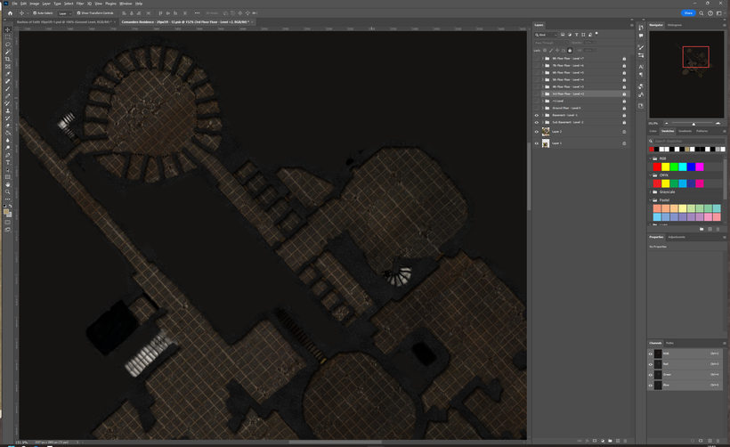
Here comes a first Photoshop template and textures I'm using for my encounter maps. For those of you who are experienced users of Photoshop this might be too simple, and for those of you with little experience it might be too complicated. Hopefully some of you will find it useful.

The Sample Map has a little house with an attic and a basement. The different floors are on separate groups and the elements on each floor are in each of those groups.

You can download the files here:
Map Example(379MB): https://annabmeyer.com/Downloads/EncounterMaps/Encouner%20Map%20Example%20%4020px5ft.psd
Map Template(377MB): https://annabmeyer.com/Downloads/EncounterMaps/Encouner%20Map%20Template%20%4020px5ft.psd
Encounter Map Textures(10MB): https://annabmeyer.com/Downloads/EncounterMaps/Encounter%20Textures%201000px%4020px.zip
I will do more work on Twitch and Discord using this template, so if you want to have more information, ask questions or just see how I go about using join the live streams!
Happy New Year!! 🙂
Year of Contradictions
This year been a roller coaster for me, both personally and professionally. Seems to mirror the state of the RPG hobby in general in a way, WotC keeps stumbling while still somewhat holding on to the crown. So many other publishers have risen to the challenge and have been publishing a whole range of innovative games, supplements and tools. Our hobby is taking a step forward into a more diverse future, which I think is a good thing.

For me its been a year of mistakes, struggles, and creative highs. I've lost several people that have meant a lot in my life this year, the last one a week ago. Despite living a privileged life in Southern California, war and loss, have touched me like so many others around the world. Almost daily I see post from friends in the industry suffering from loss of income, illness and uncertainty and suffering in many other ways. I had a computer breakdown due to a power failure and had to rebuild it (twice) and change out parts, and get a powerful APU to protect my hardware and data in the future. This proves that you should not try and save money on protection, problems will hit you from time to time, so be prepared.
This is depressing, but also highlighting my relatively good position thanks to all of you who keep my going, both literary and figuratively. You help keep my financial situation from ruin and you keep me coming back to mapping Greyhawk again and again when I feel like giving up. After my computer breakdown and I had to dig into savings and get things going again I had my first really serious wish to stop mapping places that doesn't exist and trying to get a real job instead. When I feel the worst, my long established coping mechanisms kick in. Work hard, exercise and sleep. My instincts are to keep to myself and isolate, trying to make up for my shortcomings which is a dual edged solution.
I took a week off and then came back determined to try my best and make it work. My reason behind this is that 2023 has also been a year where I feel I have developed more in my skills and creativity than any other time in my decades of doing this. For the first time I'm starting to get a deep understanding of both the tools and also a much better understanding of Greyhawk and a vision of what I want to do. Earlier I just wanted to make the most detailed photoreal maps possible, now I think I've found a way to balance the visualisation of the world and its details and the needs of the game and what to leave to be imagined by us when when play the game. This have led me to add a bit more emphasis on things like heraldry and the history and development of places as well as maps themselves.
Missed goals
Time to go over all the things that have not gone well this year, and that is a long list. First out is my high $50/month tier which quickly turned out to be a bad idea that I wasn't ready to handle. I had the idea that I could organize and channel the interest I'm custom maps I received on a regular basis, but it it ended up with demands for things I felt I wasn't very good at doing, and this means I got even less done in a the little time that I had to do it. It is not my strength to quickly doodle something that i haven't formed a vision for. My own projects I plan in sages trying to build n previous work and reusing knowledge, assets and already made stuff. Now I was often finding myself in unchartered waters with only a limited time to produce something, that does't suit me well at all. This is something I will have to try and reach out next year to all who has been affected by my shortcomings and try to repair the damages I've caused.
Commissions follow a similar line, but with me feeling a bit less guilty. I had several commissions in the pipeline for 2023, and one way o the other they have all been failures. One I worked on for 5 weeks, and produced a map I'm really proud of despite having to rush it a bit. Delivered it, and never heard back, not even a thank you. Another big project I am involved in are being on hold for now, and no one knows when or if it will get going again. The third project broke down due to communications and unrealistic demands, so I pulled the plug on that one at an early stage. Being in the situation of not having to grab every opportunity makes this possible for me, how other freelancers who are not so fortunate have to suffer through I can only try to imagine.
All of this turmoil and my way of coping with it lade the ground for the next big failure in 2023, lack of communication. I'm so glad I have a presence on Twitch, both on Jay Scott's LordGosumba channel and my own mapping live streams. They have a time and place, and they force me to interact with others, and are hard to opt out of. Once the streams are going I love to do them, but I often feel dread before, especially for doing lonely mapping live streams. Afterwards I feel much better having done them. The same goes for my games, I dread running games before the sessions but love to do it once we get started and I fell the engagement from the players, afterwards I feel great.

Lendore Isle and Ratik
A discussion on missed goals would not be complete without mentioning Lendore Isle and Ratik, my two announced projects that have not yet been received enough attention and love. Lets start with Lendore Isle, that won a vote to be my next project years ago. I then worked on if for quite a bit and then it got complicated. I worked with Len Lakofka to try and make my version to be compatible with everything he created for the Island. The first hiatus came when Len got diagnosed with cancer and we had to pause. This also gave me a time to improve my skills since I felt they were not up to the task. Around two years later when Len had recovered work commenced again at a lower pace, but tings where moving forward and my skills had also improved. A halfway decent terrain became the result of it, which wasn't bad, but not good enough in my opinion. I started to figure out how to improve things when Len's cancer came back and the project was on hold again. We now know that Len never recovered from the second round, and my Lendore Isles have to continue without him. Then I was informed that there was other Lendore projects underway in the Greyhawk community and I decided to hold off a bit and see what came out of it, and have even more source material to work with. That is where I am now with my Lendore Project. I'm ready to start again soon, and I have a hunch that Lendore might be a perfect test case for trying out Gaea 2 when it comes which should be soon.

Ratik is more straight forward, I did a "best I could at the time" effort which I felt was far from where I wanted things to be. It was my failed work on Ratik that led me to realize that I needed a new approach. I sat down with World Machine and tried to work out solutions to the limitations with rivers and large terrains. It took me a couple of years to get a decent result, and in the meantime I overhauled my Flanaess map and extended it to include Hepmonaland which could all be done using Photoshop and Illustrator. I used Shield Lands and my own campaign as a testbed for a new generation maps. I will get back to Ratik, it is an area that geographically is the closes to my native Scandinavia that it is irresistible for me. I want to show of my mapping prowess with a cold temperate land with deep forests, mountains, mighty rivers and all the other features of this type of terrain.
This have been a lot of negativity, and I felt it was needed to write it, get it said so you know more of what is going on. From now on its going to be positive stuff, because there are a lot of that too!
Accomplishments
I have posted over 40 times on my Patreon blog in 2023, which is not too far of my goal of a weekly post. Some post are very quick small things that doesn't count for much but others are long essays with lots of graphics which makes up for the shortfall a bit.
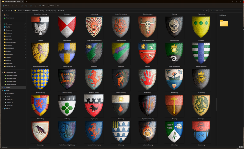
The big hit this year, if I look at positive feedback, must be heraldry with close to 400 shields made all in all and around 150 made in 2023. It is fun, and doesn't take weeks and months to finish, they tie into the lore of the setting, I love to do them so expect more heraldry and related stuff like banners and flags going forward.

My next accomplishment I'm really proud of is that after a decade of trying to establish a new "mapping standard" after retiring my old Bryce based Flanaess mapping, I have finally managed to find a new workflow that get me the results I want in a predictable manner. It was a long slog of trying to figure out how to do it, I've tried half a dozen tools and spent several years of work trying to get my feeble brain and equally underpowered computer to force software to do that it wasn't made to do. Shield Lands have been my test bed and now I'm getting the results I have always dreamt of, and I have found my new style. Now I want to sit down and work on if for several hours a day to just do this and in a few years I will have mapped a significant part of Greyhawk in this much better way.

My next accomplishment this year is to finally have my GIS conversion project well underway. It has been a lot of learning to get to this point. GIS is difficult enough when all you need to do is to present data in the form of a good looking map. What I need to do is to first create the data to be presented which makes the whole thing much more difficult. A lot of the ground work is now done and I'm making daily progress.
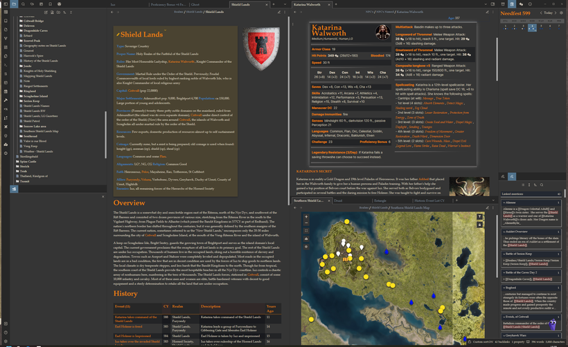
2023 was the year I organized my own Greyhawk campaign properly, from having lived in old binders, word documents, RealmWorks, Evernote and even an old Access database - it is now being properly organized in a Obsidian.md MeyerHawk vault. This have been a godsend in improving my knowledge and vision of Greyhawk and ideas for both my campaign, heraldry and blogposts have come from it. The Iuzian Zombie Goats came from organizing my Iuzian notes. Hand in hand with this project have been my House Rule development, my first serious take on the rules of my own games. So many great D&D creators who have given me inspiration and insights in RPG design, which have guided me in my work trying to make my own version of the game suited for my own games, more on this project below.
My website upgrade is worth a mentioning here, but for the amount of work it involved and also to remind me that it is time for another overhaul again very soon. Way more content is being hosted on it, and it need to be found easier and presented much better. I'm looking into solutions for this, and also trying to plan for hosting things like GIS map server and my rules database as well. This will require way more, and there are lots of options.

The March of Moore's Law
Progress in the world of tech that seemed to have been sputtering a bit for some years is coming back, big time. Both hardware and software are making advances that affects what I do. The most obvious one is AI that have now reached a level maturity that makes it both useful, disruptive and potentially dangerous. The view in creative circles here in the US are, for very good reasons, very negative pointing out things like, sourcing of the training data, job losses and other negative aspects of the technology. In my native Sweden the view is way more positive with a much more probing attitude of how can these tools be used, what are the limitations, and a the negatives are much more focused on security risks, political influence, hybrid warfare, cyber weapons, augmentation and control of lethality in warfare.
In many ways the opposite from here in the US, and I'm torn between the two views seeing merits in both ways of looking at AI and its implementation. Short term I'm to benefit from it, it can help me do better work much faster with things like programming, augmenting procedural workflows, quickly create textures and other assets and more. In a some years, a lot of what I do can probably be done by AI with a bit of guidance or at random by publishers and DM's to create the maps they need without the need for me to do them. This doesn't mean I will be out of a job, just that I have to shift focus and concentrate more on helping others shaping their vision and how to use the tools, which means I have to start building my social skills and online presence more as a way to prepare for the changes that are coming.

Terrain creation tools have been in a "semi-sorry" state of stagnation for a decade, and I was starting to accept the fate of having few new cool tools to work with any time soon. Thankfully this seems to come to an end, new tools are coming. First out is Gaea 2.0 that has a juicy feature list of stuff that I've been wanting since Gaea was first launched, like support for large terrains. The fact that Unreal 5 now supports large terrains and other game engines are coming with support for whole planets will, if I'm right, turbocharge the development of terrain tools for creating whole worlds. My guess is that Houdini, and probably Unreal as well, World Creator, Terragen and probably Vue will come out soon with support whole planet and world terrain creation. Technically Terragen and Vue have had this for years, but its too clunky, doesn't support rivers and water properly. This will change soon I think and there will be too much to choose from, which that is a good problem to have. It also seems like a set of data standards are emerging like Cesium 3D tiles, glTF, usd/usdz and others, which a key ingredient this field really needs to take of.
New hardware is coming too, CPU's like AMD's new Threadripper with 96 Cores, NPU's and even more powerful GPU's means I will be able to ramp up both my speed, scope and quality of my work, and the data standards means cooperation and reuse of assets becomes easier. I'm following this closely trying to figure out what tools to learn and what to save up to and invest in. GIS is an example of a technology I started to learn almost a decade ago which is now starting to pay dividends, there are other technologies that I know will be even more beneficial for my work in the TTRPG field. We see that in VTT's and other tools like character- and campaign managers, which are popping up everywhere these days incorporating the newest tech. Its early days yet and very little thoughts on interoperability, data standards and overall usefulness. Most of the energy seems to be to build a content store, and create a closed in ecosystem to try and squeeze out profits. This is a great approach if you want to attract investment dollars and make a profit, but detrimental to DM's and gamers in the long run. Thankfully there are other options coming too, which I will definitely come back to next year.
Theater of the Mind vs. Realities of the Table
All this new tech and cool possibilities have made me question how much is too much? What is usable at the table (real and virtual) and what is excessive and of little use in our games. This varies of course, different games styles, and where we game around a real table or a virtual, what props we use (if any) and our personal likes.

A lot of the maps and illustrations that are now becoming available, in modules, VTT's and that can be created using more and more sophisticated tools, seems to give you more and more details but with a narrow focus. A couple of super realistic and detailed rooms, a glen, or a river crossing for example. For most gamers this must be the right way to go, I say this since my assumption are that most creators makes the content they see as useful. For me the opposite is more interesting, a wider focus and less detail. I want to know where my character is in the world, what are the options in case we have to retreat or flee. Few things are more satisfying than to be able to read the landscape and choose a wise plan of attack, very few games I played in let me do that as a player. Most encounters starts in a situation that is preferable by the DM to tell the story, but gives very little player input. Smart, savvy, heroic characters would probably have avoided the whole situation if the players would have seen all the options their characters where facing.
My goal as a DM is increased overall player awareness combined with theater of mind for details and minutia. This require detailed landscape, and settlement maps, and simple maps of locations. Rooms and indoor environments can be a bit closer to old school visualisation that the near photoreal maps often seen nowadays. Travel and exploration demands a good grasp of the land by both players and DM. An interesting side effects of using very detailed maps covering a whole area is that getting lost is a very real proposition. When you use fog of war and only see to the horizon, choosing the right trail or shortcut become tricky. Blurring out things in the distance, and slightly rotate maps over time was tricks I have used on my players to great effect. Survival rolls to find they way can be vital to get there, and ending up in the wrong place can lead to very interesting adventures, especially if the players have made the active decision to go there, rather than just failed a roll.

Depth of a Setting
How much detail should go into the lore, things like music, food poesy and visual art are great, but do they add to the game or are just a waste of prep time? Just like in the previous paragraph, it depends, but I still think it is important for DM's and players to figure out what types of detail are important and to what degree are they beneficial to the game. Take heraldry for example, some heraldry are probably a great addition to most Greyhawk games. If you run a lore heavy game where political intricacy is key you can make good use of way more heraldry than a game where exploring dungeons, killing monsters and taking their loot is the name of the game.

For me as a Greyhawk content creator I'm of course is making things useful for my own games, that way I can put in passion and dedication. At the same time I have to keep an eye out for what can be useful for a wide range of Greyhawk gamers, it is a balance which keep this endeavour varied, challenging and interesting. I'm mentioning all this because it is a discussion I have to have both with all of you, and with myself in order to evolve and be able to improve on what I do.

Governing the Play - House Rules Project
Love them or hate them "The Rules" are key to what we do, and since we like to do it in different ways we need different rules. I've been wanting to dive deeper into games design since my early days playing TTRPG's in the 80's, but I felt I needed to know more before being able to make a useful contribution. I concentrated on making maps and the like for my games instead, but this started to change a bit when I had all day to spend on mapping Greyhawk. Thanks to the explosion of blogs, YouTube channels and great tools for handling information I felt it was time for me to dive a bit deeper into game design. My ambition only stretch as far as making a version of D&D that is customized to work well at my table for the kind of games I want to run. Like with my maps I want to share what I create. Now I feel I have both enough knowledge and the right tools to be able to do it.

An alpha version is taking shape and is not far from ready to be shared. It is a classless D&D version based on EN Publishing's Advanced 5E. It is somewhat compatible with 5E, monsters, spells and items can be used as they are. Characters might need a bit of tweaking, but the basic math is very close to vanilla 5E. Working on divine magic at the moment, it will come in both domain and pact versions. For example you might be able to strike a bargain with a powerful monster, like a demon lord, a dragon or Asmodeus himself (if he is so inclined). This can give your character cool benefits like senses, innate magic, spells and more, but comes at a price which varies due to who you strike the pact with. It is an alternative to (or combination with) the more traditional divine domain magic that you are given by becoming a cleric.
GIS
Work on a creating a GIS based version of my current Greyhawk map is well under way. I'm nearing the point where all the settlement data are entered, then its time for roads borders and then all the geographical and political labels. This data entry phase will be done sometime next year, hopefully before summer. This first step means we will have a geopackage that I will share and make available as Creative Commons, just like the current map, but this is just the beginning. Now that the data is entered the fun begins. The style I'm using while entering the data is suited for digital use, which makes the most sense since its purpose is to make it easy to use inside QGIS. Other maps need to be created for other needs, like print, spread maps and much more.

Sources Project
Before I get to all of the new styles there is another GIS project that is VERY long overdue that I'm going to start next year, that many of you have been asking for since I first published my map on the web. I'm talking about a Reference Project, now thanks to GIS all the information will be in a database which means its is now much easier to search for, and list, sources for all the data on the map. The goal with my Reference Project is to give references to where a name comes from and where to find more information. This will be a useful resource for Greyhawk gamers, but especially to all newcomers who are starting to play in the setting. I have built a fairly extensive digital database of Greyhawk content collected over more than 30 years and I keep adding to it almost every day. With the help of all the experts in the Greyhawk community I think this is going to be doable in a year or so.
Another very important side of this project is how to organize, present and share all of this information. It needs to be available both in an online and a downloadable format. I have many ideas, that needs to be tested, and I need lots of help and input from the community on how to this right. It is a resource not for me, but for the whole Greyhawk community and it needs to be as useful as possible.
City of Hawks
Next year is the 50th year anniversary of D&D and a good time to start the project every Greyhawk mapper have to tackle, the city itself. I've been doing this for 30 years and professionally over 10 and now I feel like I know a bit about what I'm doing and also have a bit of knowledge of the setting, and a vision of what I want to do.

My goal for this project is to create a vision of the city that includes all the awesome stuff we have learned to love over the decades we have adventured in, under and around the famous city, and present it as a real place that is impressive enough to be an home for Greyhawk campaigns for a long time to come.

A rough overview of the project that I estimate will take up to 5 years working half time on it.
Phase 1: POI and facts gathering, basic layout and rough placement, documentation
Phase 2: Basic Terrain building
Phase 3: Layout and POI placement
Phase 4: Terrain Detail and Rendering
Phase 4: POI detail
Phase 5: Editing, Enhancement and Presentation
Oerth
My Oerth Project is under way which has so far mostly about finding my vision for the planet Oerth. It is mostly a sketch and think project that I have to give enough to to think build and refine my vision of the planet to be both inspiring, useful and a good base to properly map the Oerth in detail.
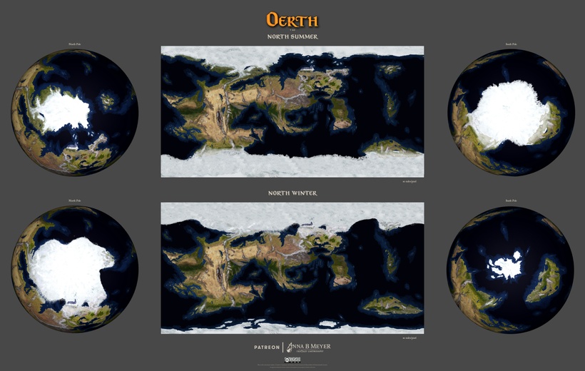
One of my main goals for my Oerth vision is to make the plane a suitable home for a multitude of settings. The planet is vast had has lots of room, way more than I've seen anyone given it credit for. Both the DA1 map and the new Chainmail maps showed ludicrously oversized realms which to me made the inferior cartography even worse, but it is lore and I want to pay it some love so I'm trying to keep some elements from them. When I have a continental layout I'm happy with and have done some climate and and other overview maps it will go out into the Greyhawk community for a verdict in 2024.

Oerth will be a side project in 2024 with a possible first model in 2025. I'm aiming for a resolution around the current Flanaess Hepmonaland map, but in 3D. The trickiest bit will be Flanaess and Hepmonaland, where it will be very hard to match every detail. I will concentrate on other parts of the planet first and as I learn a workable solution will hopefully emerge, or we have to put this project on hiatus until I have caught up with the Flanaess later. Maps o the rest of Oerth might be very useful even if they don't have direct matches in the Flanaess. I'm making a bet here that both my skills and the tools will have improved enough in a couple of years to make this possible. It might even be the best way to go about mapping the Flanaess, start out with a lower resolution and then make high resolution maps based on them later.

Heraldry
This have been one of my biggest joy this year, and not only have that led to a lot of heraldry, it has also enriched both my campaign and my understanding of the setting. I fell in love with the shields in the Greyhawk 83 Boxed Set, and that have now come full circle with me adding to the Greyhawk heraldry tradition.
Apart from over 100 individual shields I've done two heraldry compendiums, which is not much yet. My plans with are to keep doing them so they can be added as pages into a book or binder. I'm working on both the Horned Society and the Great Kingdom, which I hope to be able to have done during spring. Then I want to do compendiums for Keoland, elven, Dwarven, Nyrond, The Lands of Ferrond and the Baklunish are on my list.
Twitch, Discord, Social Media and the Web
Apart from increased Twitch presence and an website upgrade, this had been a year of me underperforming. This needs to change for many reasons, and I'm painfully aware of them all. My base goal in this area are to get back into writing more, and I will treat it like PT, force my self to do it. Writing is weirdly similar to physical exercise to me, my body and mind hate the thought of doing it, making me procrastinate as much as possible to avoid it. But once I have done it for a bit I get a high from doing it, and afterwards I feel like I've accomplished something. For the record, I also feel I'm not good at either writing or being athletic. Now I have chosen a job that requires me to write so I just have to do it, and try to get better at it.
Number two on my communications agenda are Discord. It is a great resource that I'm not using anyway near enough, and that need to change. I like Twitch streaming, and as a compliment I will start work hangouts for patreons on Discord, trying to spread them out so they can be accessible for people in different time zones. It can be fun, and worse case scenario I have to sit and work at my desk like I usually do which is not bad. It can be better than Twitch with audio chat as well.
Hosting my content in a better way that present it better and makes it easier to find is a high priority. I'm currently using WordPress and Oxygen Builder for my website. I also have a Notion that I've worked with a bit, and now I'm a heavy user of Obsidian and love it. Somehow I have to figure out how to best create something that works to make my content available in a better way. Might be needing more than one solution for things to work well, Obsidian has a neat publishing service, that makes it super easy to publish your Obsidian stuff on the web . The downside are that the publish function doesn't support community plugins, which makes it a lot less useful for me. Its the database functions I need the most and they are coming natively to Obsidian soon, and this might make Obsidian the easiest option to publish content that aren't big maps.
GIS maps can be distributed in various file formats, like geopackages, geoTiffs etc., or be hosted on a sever. Ideally I need to offer both, and that is what I'm aiming at but it will take some time and cost for the server part. Notion is an option to keep in mind as well, it is very powerful and easy to use, and the costs are reasonable. For the heavy lifting of source PSB-files in 10GB size or more I need some sort of Cloud storage, Dropbox would work but is limited in size and I need it for other things, so other options need to be looked at.
Patreon
My Patreon tiers are in dire need of an overhaul, they are confusing even for me. I'm working on new tiers and rewards, and I will make a detailed post about my plans and the thinking behind it early on next year.
Conventions
In order to keep my cost down I have kept my convention going to a minimum, only attending Gary Con this year. 2024 is a gearing up to be a special convention year as well with the double convention in Lake Geneva in March, Founders & Legends and Gary Con in a double weekend bonanza. Convention staff work, seminars, mingle, and even a bit of gaming is on the agenda. Really looking forward to this, might be the best convention ever. I'm going to work really hard to have new stuff to show off!
Before I flew for real to Gary Con in March 2023, I flew there virtually from SoCal in my Vertigo single engined turboporop plane using the Microsoft Flightsim, VR and my cockpit setup. It was a fun set of flights across western and central US to Lake Geneva Wisconsin. Here are some screenshots from my flight, lots of beautiful scenery and very varied weather. The low resolution and weird shape are limitations of VR screenshots, in the VR headset the resolution is many times higher.

My virtual Vertigo

Mountains, winter weather and rainbows.

Dramatic winter weather..

early morning, winter weather and mountains, are gorgeous even in VR..
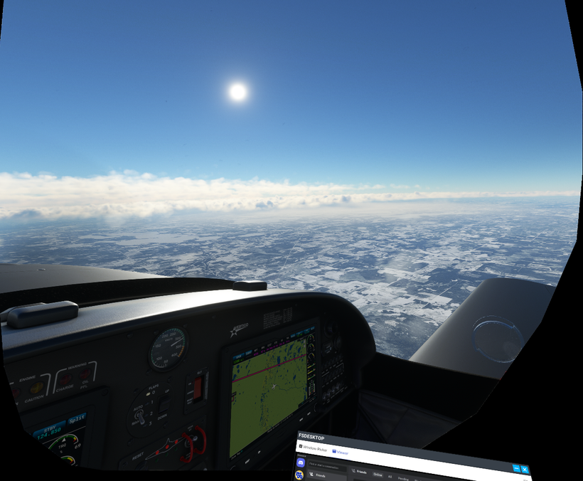
Frozen plains of the Midwest, and keeping an eye on Discord while flying!

We are here, Lake Geneva Wisconsin in winter dress.

Lake Geneva seen from the south, Grand Geneva and the airfield are visible to the right. Ready for Gary Con!
Thank you all so much for your support in 2023, it has made me look forward to 2024 with a positive mindset!
I which you all Happy holidays, Merry Christmas and all that!!
Anna
Here are my updated symbols, a thousand of them all in all in both SVG and PNG format!

Even the 1000 different symbols doesn't cover all the possibilities, underwater versions are not included yet, they will be added in a future update.

SVG version are vector and can be scaled to whatever size you need and PNG versions have transparent background.
You can get them here:
https://annabmeyer.com/Downloads/Symbols/GH%20Symbols%202023%20PNG's.zip
https://annabmeyer.com/Downloads/Symbols/GH%20Symbols%202023%20SVG's.zip

Another achievement of the Greyhawk community, a Gazetteer covering lands far west and north of the Flanaess. This is brought to you by:
Author: Crag
Contributors: Paul “Artharn the Cleric” Jurdeczka, Troy “Cannibaal” Alleman, Dave “Bubbagump” Coalter
Editing: Paul “Artharn the Cleric” Jurdeczka, Cruel Summer Lord, Dennis “Argon” Lovatt
Cover Art: Dan Smith
Interior Art: Dan Smith
Cartography: Troy “Cannibaal” Alleman, Anna B. Meyer
Layout and Design: Lee “Savage Baron” Schaidle, OJ Journal Staff
Special Thanks: OJ Journal Staff For Conceiving The “Beyond the Flanaess” Project
Marketan Military Consultant: Sam “Samwise” Weiss
You can download it here: https://annabmeyer.com/Downloads/other/Domain_of_the_Despotic_Giant_King_Digital.pdf
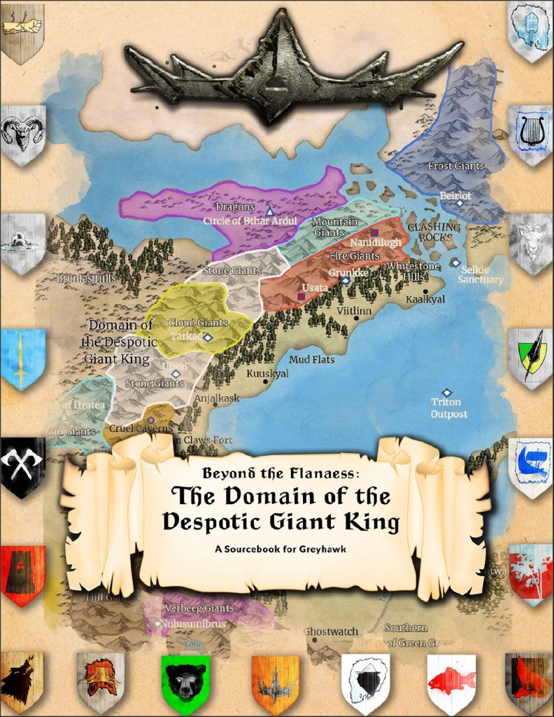

An updated version of the Gulf of Ghayar Gazetteer is here! This beefy fan creation Greyhawk sourcebook is great asset for all who adventure in the setting. Huge thanks to everyone helping out on this project!
Author: Crag,
Contributors: Mike ”Mortellan” Bridges (Yellow Cartel), Skip “Sir Xaris” Twitchell (Hydrothermal Vents), Troy “Cannibaal” Alleman (Underwater Atlas).
Editing: Dave “Bubbagump” Coalter, Dennis “Argon” Lovatt, Gary Holian, Paul “Artharn the Cleric” Jurdeczka
Art by: Dan <SMIF> Smith and Adam “unemployed_bullywug” Koca
Cartography: Troy “Cannibaal” Alleman, and Anna B. Meyer
Layout and Design: Lee “Savage Baron” Schaidle, OJ Journal Staff
Special Thanks: OJ Journal Staff For Conceiving The “Beyond the Flanaess” Project
You can download the pdf here: https://annabmeyer.com/Downloads/other/Gulf_of_Ghayar_Combined_Digital.pdf