Just back home from PaizoCon 2018, and after a great weekend it is time to get back to work again!
First out is a revised list of the fonts I use on my Flanaess map. These fonts should still be available on font sites like http://www.fontpalace.com
Very useful to have if you want to make changes and want them to look the same as the labels already on the map.
Working on exporting all the symbols as PNG and SVG images.

I'm packing my suitcase for PaizoCon 2018, flying from San Diego tomorrow morning.
I will help out in the booth of Lonewolf Development during the convention, and try to socialize as much as possible with friends and colleagues, so if you're at the convention don't hesitate to try and find me!
I will have my laptop and try and do some mapping as well between shifts.
One of my goals is to post something useful at least once a week. First out is a piece of heraldry of my own design, but I'm grounding it in firm Greyhawk lore.
The shield of the Naelax Overkings of the old Great Kingdom. My design is based on the cover image of WGR7 Ivid the Undying. The module was never officially released, but became available later as a free download on the then young internet.
I have created it using Adobe Illustrator, and the image is available in three different formats:
JPG as seen above with drop shadow and text.
https://www.dropbox.com/s/pz27hqewrpi1fx3/Ivid-01.jpg?dl=0
PNG shield only with no drop shadow, and transparent background
https://www.dropbox.com/s/7ckogovldkp21n1/Ivid-02.png?dl=0
SVG vector format, but otherwise the same as the PNG
https://www.dropbox.com/s/d20lbx7iroogv3w/Ivid-02.svg?dl=0
This is part of my effort to expand the heraldry for my Greyhawk campaign. Also a good way to improve my Illustrator skills, since heraldry can be quite intricate. But I try to keep the symbols simple so they can be used in my cartography and work well in different sizes, therefore I need to make them using vector graphics.
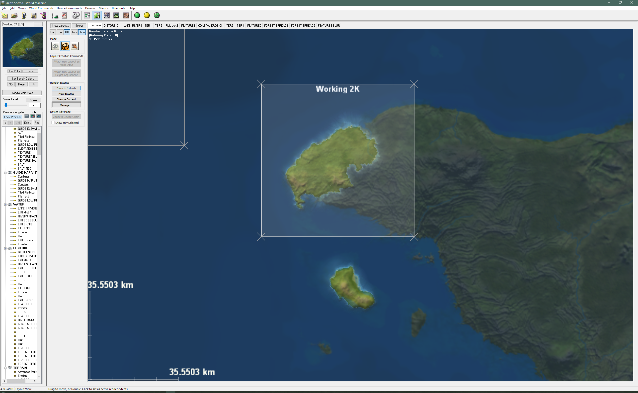
Here is the first part detailing how I work with World Machine. It gives and overview and goes further into Extents.
You can download the file I'm using here:
https://www.dropbox.com/s/229ms7q5jav3j1k/2018_1-30m-3%20setup.tmd?dl=0
It is a corrected version of the previous file. I've removed some of the clutter, but kept all the vitals. This file only has elevation color and no textures. But all the terrain generating functions are there as well as Rivers and Lakes.
Part 2 will cover Base Terrains.
Twenty years ago I started mapping the World of Greyhawk for my own campaign, and then decided to share my work on the then emerging Internet. The rest is an history most of you who read this already know about so instead of looking backwards I'm going to try and look forward. I've decided to start all over again. Yes I mean starting all over again with mapping the Flanaess, and its surroundings. What on Oerth can make me come to this conclusion?
I want to do this again for three different reasons. The first one is that I know have the experience needed to do it properly. Second, technology is now beginning to be powerful enough to make it possible to do it right. Thirdly I'm so passionate about it that when I see a way to make a much better job I just have to do it!
It took me more than five years of full time work last time, and to remake it the way I want to is not going to much easier. My estimate for this is for it to take around 5 years of work. How long that will actually take depends on how much time I can devote to it. If I do this as a hobby like last time it will be a decade or so. Thankfully there is a way for you to make it possible for me to devote more time to it, support my Patreon. With a little bit more support mapping the world of Greyhawk will be an ongoing project that I can treat as an commissioned project, with more support it can be my major project or maybe even a full time undertaking. We will see how that develop, it will be my hobby and passion anyway, and also be a big part of my research and development. so I will work on one way or the other.
So what are goals this time around?
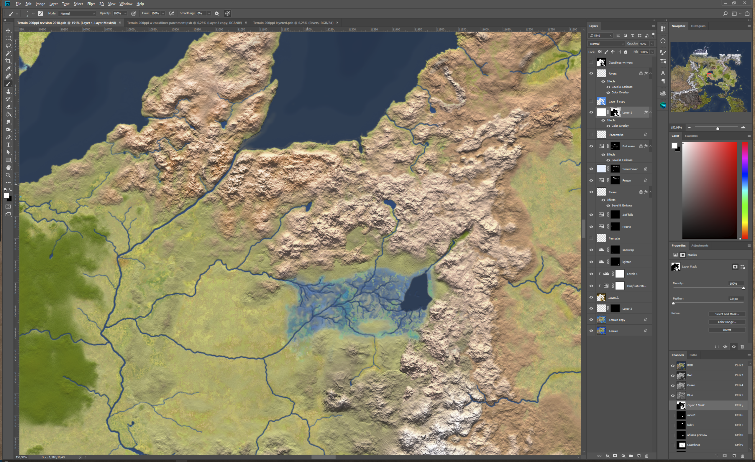
Full elevation model with increased detail to 100/pixel. Enough to make it useful for outdoor adventures by visualizing what an area actually looks like. This can also serve as a solid base for city and encounter maps to be developed that will match the surrounding terrain. Below is an example of the difference in resolution and a proper elevation model.

Global Precision, the Flanaess needs to be accurately placed this time to make it possible to expand the project to cover other parts of Oerth as well.

Meta data part of the project from the start. I want to make use of modern GIS (Geographical Information System) standards to make it possible to keep track of things and form a base for better forms of presentation and varied use.
Presentation and format needs to be a major focus for this project. The current map is only top down in two formats, JPG and PDF. Next time the data needs to be usable in many more ways. I envision things like game engines, GIS tools, RPG campaign tools like Realm Works, webb based maps and more.
To go along with the data should be a set of graphical symbols 2D and 3D, graphical elements fonts and more specially designed to present the World of Greyhawk at its finest.

All my Greyhawk content have been free to download and published under the Creative Commons -by -nc license. This going to be the case going forward as well. If Wizard of the Coast changing their stance of Greyhawk fan created content, I might have to look into what they offer, but that is only hypothetical and my guess is that it will remain so for the foreseeable future. Creative Commons -by -nc, gives you the permission to use, alter and share the content for non commercial purposes as long as the source is indicated.
The main goal with this is that whatever comes out of this should be used by Greyhawk fans and others as much as possible and serve as a platform for anyone who wants to run games set in Greyhawk. That means that it needs to be accessible, modifiable and sharable.
How to try and tackle this huge undertaking?
I'm in the planning stage right now, and there are several bits and pieces that needs to fall in place before actual work can begin. This is what most of this year will be occupied with. 2018 revision of the existing map will be more thorough than previous years to make it more compatible with the future content. This is important since it will be years until all of it can be replaced with a new version, so the old have to live side by side with the new as good as possible. My existing map is also my main guide when mapping it again, and we want as good of a guide as possible.
The Oerth Geo Referencing project is what I will call my effort to try and place the Flanaess properly on Oerth. I will try and use all the data from Greyhawk canon sources as well as some of the great pieces written on the topic and try and implement them using GIS tools.

In order to set both standards and work-flow small test areas needs to be mapped. The first one out is the Lendore Isles. Islands are good pilot areas since they are separate from the mainland and can more easily be imported and merged with future content.
These three parts will probably keep me busy this year, and if there are time over there are always interesting tidbits to dig into. things like city sketches, heraldry and touch up other old stuff hidden in various places...
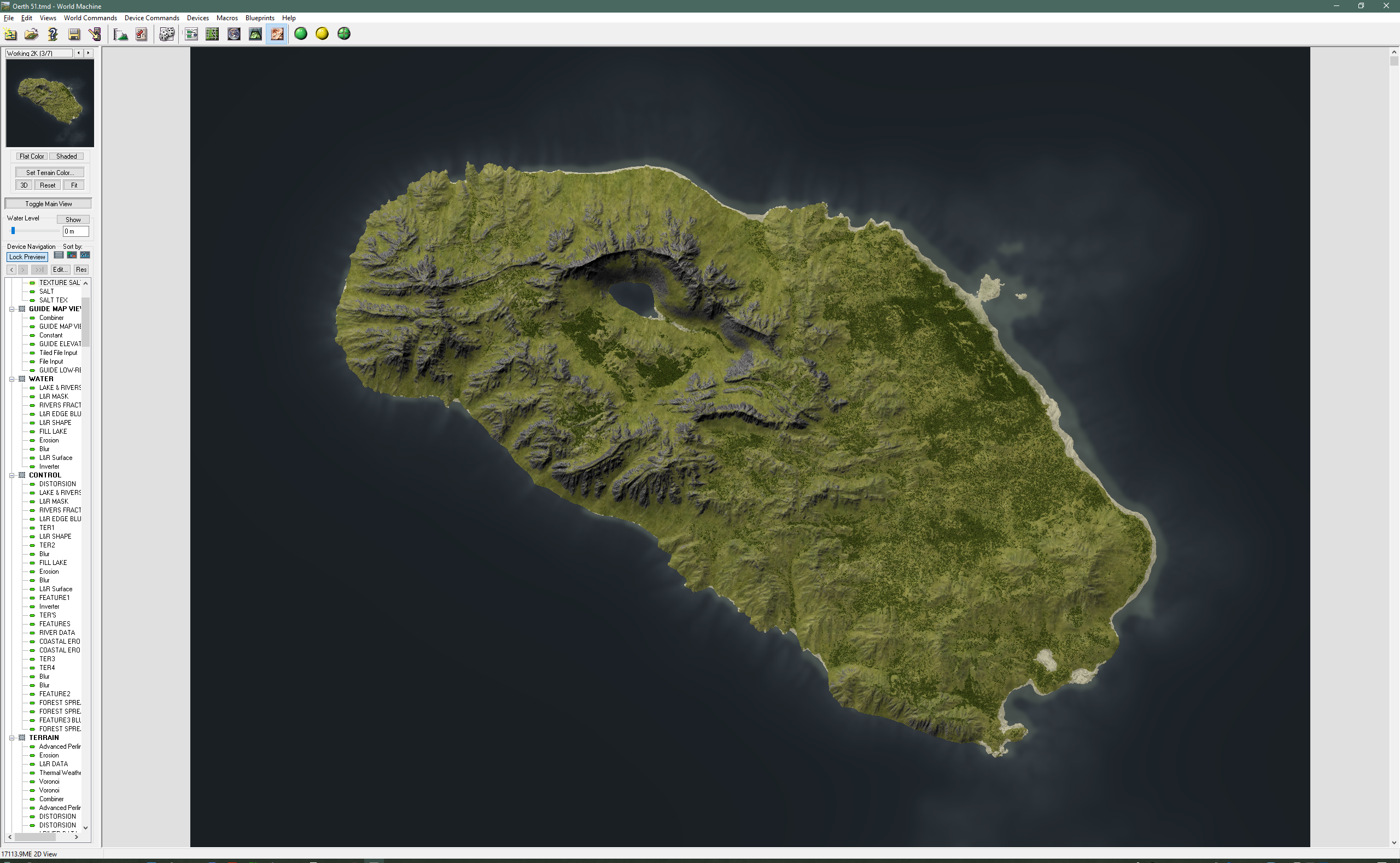
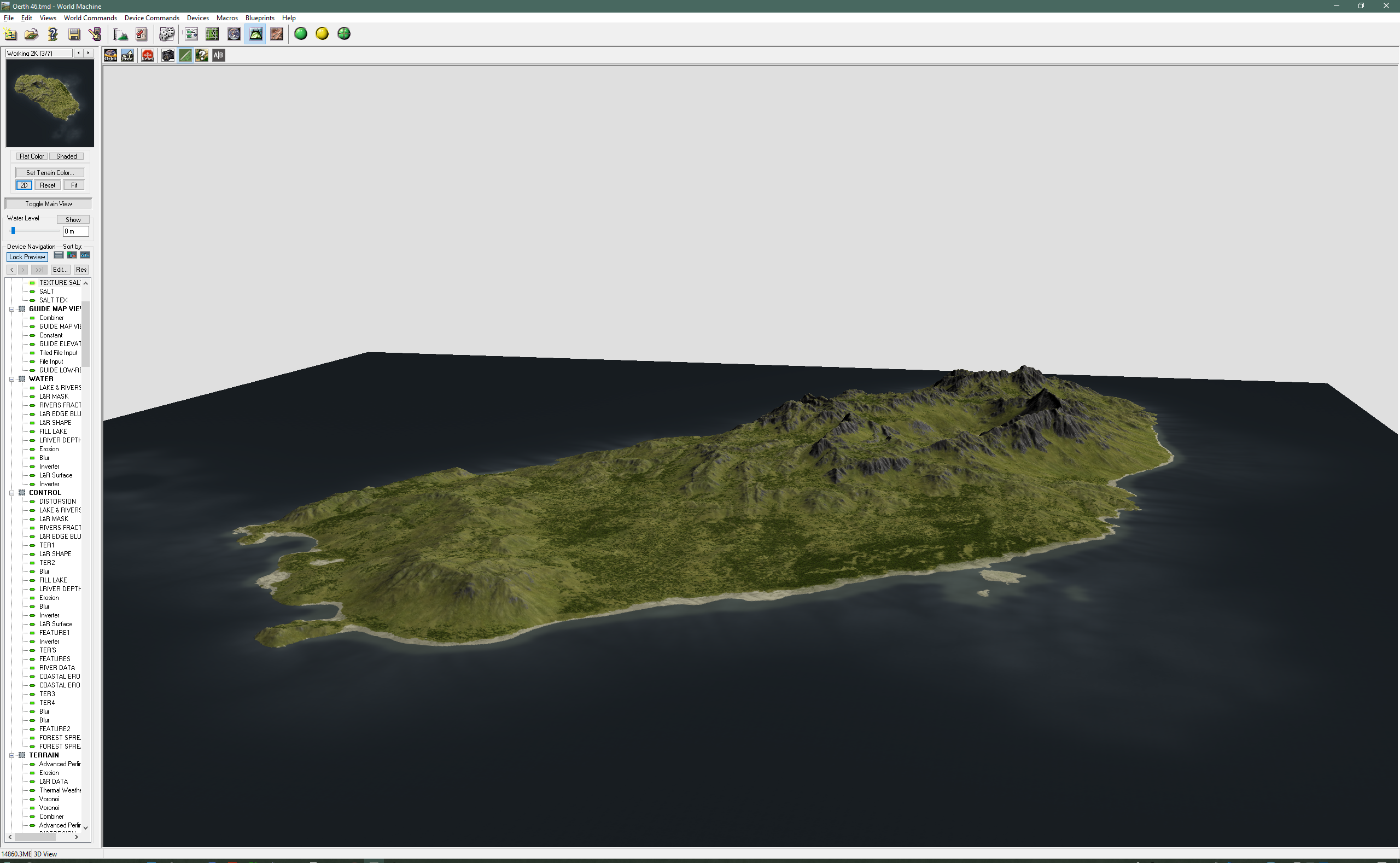
Here is an example of the latest World Machine setup I'm using for large area mapping with the output resolution of 30m/pixel.
Terrain is generated in three steps, base terrain, highlands and features. It also includes river and lakes, and something I call FILL LAKE. Fill lakes are just my term for filling any depression in the terrain with a level surface without altering the terrain under the surface, great for salt flats, mounting lakes and such that have no natural inflow or have eroded the landscape around.
The file is set up so you can easily (well relatively easily, we all know WM..lol) plug more of of each of the terrain generation routines.
Textures and forest are only rudimentary in this setup, I'm working on that part. It has support for multiple Biomes that handle general and forest texturing. The placement of forest are controlled using separate FOREST SPREAD controllers for multiple ways to place forest and you can create more as needed.
I will make a video explaining this setup in more detail soon, and there will be new versions of this as I add features. I'm giving you a chance to study it, play with it and see how I do things under the hood.
The goal with this setup is to be as modular as possible, so I can plug in or reuse parts of this in various other projects. The LAKES and RIVER functions are very powerful, in my humble opinion better than the ones built into World Machine.
To be fair WM's rivers are still in beta, and I'm sure Stephen will make WM's native river function much better than what I have managed to do in the not too distant future. But in the mean time this works fairly well.
I will make a special video explaining how it works.
You can grab the file here: https://www.dropbox.com/s/27djc970mo2611o/2018_1-30m%20setup.tmd?dl=0
Thank you everyone for the continued and even increased support!
To get things going I want to hand over something a little special. PDF and JPG copies of the maps I gave prints of to WotC during the DragoTalk interview.
These maps are parts from my personal Campaign map that has lots of extra stuff on it. Some parts especially like Ahlissa are full of additional stuff.
As a regular feature for those who pledge on the Adventure Level or above will be personal campaign maps. Next moth will be the start of that with PDF and JPG copies of my whole campaign map that have a couple hundred extra settlements more heraldry I have developed for my campaign.
You can download the files here: https://www.dropbox.com/sh/ni22gihautg1zk9/AACF08PMSfI7QLB-Ur6y3J7Ma?dl=0
The Patreon restart is now in effect with a number of changes.
Lets start with the monetary bit. I've changed to a monthly charge instead of per project, to better support a long term goal of mapping the world of Greyhawk all over again. To compensate for being greedy I've adjusted the reward levels to $1, $3 and $5.
The first charge will be on June 1st, so you have until then to adjust your pledge level, or withdraw your support. I hope most of you will decide to change your pledge and stay, but I can understand if you decide not too. To change the set up after only six months and two projects is not what you singed up for.
Those of you who stay will hopefully not regret it, there are lots of content coming. But instead of a few big chunks of it per year expect more of a steady trickle of stuff, most of it will be directly applicable to Greyhawk. Most of it will be usable for your home-brew campaign as well, there will be a non labeled version along with the one with labels.
This year I want to do the following:
This will be quite a challenge and require a lot of new thinking, but with your help it can be done!
For those of you who pledge on the Cartographers Level this means there will probably be more advanced stuff to dig into, so for you this is a change but also a plus. Things I know will be covered this year are:
and more!
I have a new campaign I'm working on, and it needs to be mapped, so expect tidbits from a side of my mapping I have rarely shown before.
Thank you all for for your support, and I hope will stay on for more!
It has now been over 6 month since I started my Patreon and so far I've done two projects. The first one Craters was well managed but with questionable usability, and the second Islands was terribly managed but with great results but with caveats (more on them later). The outcome and especially the feedback from you guys have taught me some hard lessons.
The main one is that Patreon is not well equipped to handle distribution or management of content other than images up to 200MB in size. I've used Dropbox and my website as placement of files but that cause problems for some people depending regardless of size and most of you when the files are bigger than a few hundred MB.
To run things as projects also seem to go against the blog nature of Patreon. My goal this year was to try and do four projects of roughly a months length each with commissioned work filling out the rest of my time. The Island project was overly ambitions which meant it spanned over nearly three months and resulted in large number of massive files causing issues for many of you.
My goal with this Patreon was to be able to create something in direct connection with you guys. Balancing it with my commissioned work and working on advanced things as a way of improving my skills. This I don't want to change at all, except to say that with enough support for my Patreon it could become more important, meaning I can spend more of my time working on creating for my Patreon.

Greyhawk have always been the go to setting for my own games, and the place I use as a base for my efforts to improve and learn. It was always my intention to use my Patreon projects as a base for Greyhawk work, but it might be better to do things the other way around. Focus my Patreon work on mapping the World of Greyhawk and use what is being learned to create other things on the side from time to time.

My proposal is to change things a bit, and change is never easy so this have to be something you will have a big say in and time to adjust to (or leave my Patreon if you so want). Focus is going to be not on a few projects a year, instead an ongoing long term effort to develop and use the techniques to map a game setting in full detail. So the results will not be neatly packaged content now and then, but more of bits and pieces of Greyhawk related material of various forms and shapes with generic stuff mixed in on a more regular basis.

To better suit this way of working I'm proposing to change my Patreon to charge a monthly fee. This needs to be a smaller amount and fewer tiers to simplify and compensate, I'm thinking three tiers at $1, $3 and $5.
$1 for those who just want to support my effort and get the final results early.
$3 for those who want to take a more active role in the development and have a say in how and what I should do in what order.
$5 for those who want to have an insight in the technical side of things and get source content and how to information.
The final Flanaess 2.0 content will be released as Creative Common -by -nc just like my previous maps. Patreons will get early access to the material and also get credited. I'm also willing to dedicate special commission spots for Patreons, with discounts based on the support given thought my Patreon. Details for this have to be worked out. I have to add a disclaimer to this: in case WotC opens up DM's Guild for Greyhawk the situation might need to be looked into again.

So what do I want you to give me money for?
To put it bluntly, I want to spend more time working on projects that I'm really passionate about and give the content away to the community when I'm done. I will always spend a bit of time I have left over to do this simply because I love to do it, and it is the best way for me to improve. This means I might spend from a few hours to occasionally a day per week on this, and I would get the Flanaess done within a decade or so. But with your help I could spend more time and have it done in much less time, and also have the means to create something better.

My plan forward look like this:
Initially three different projects run in parallel, a 2018 revision of the existing map, a couple of test areas for Flanaess 2.0 mapping standards and set up the grounds for placing the Flanaess (and other continents) properly on Oerth.

Flanaess Map 2018 Revision
For the first time since 2013 I will edit the terrain to make it more compatible with version 2.0. Adjust colors and add and revise certain details as needed to improve it. There will also be the usual addition and correction of settlements and other symbols.
Flanaess 2.0
- This will be a completely new map using the exiting one as a guide.
- The level of detail I'm aiming for is a data resolution of 100 ft per pixel, roughly 10 times better than the existing map.
- Multiple types of data, like texture, elevation, masks and more. This will make it possible to create all multitude of versions for different uses and platforms, like Webb maps, game engines etc.
- Presentation is major part of the project. I want to have several different styles created that can cater for both the in game prop type maps as well as the full visualization of the setting.
- The data need to be stored in a form that makes it possible and easy to create more detailed maps of key areas or global maps that match each other in the same way real world maps do.
- Special renders, think landscape photography.
With a setup like this you as Patreons might get a bit less polished content at first, and it will be in bits and pieces. But I'm sure it will be more and more of it the further we get into this project. When it comes to the technical side of things there will be less huge files, but more technical know how on a more regular basis.
I have created a discord server: https://discord.gg/vgqSqd
I will create special channels for Patreons and in the future start some form of live mapping sessions for Patreons.
A more in depth presentation of Flanaess Map 2.0 with more images will come soon.
My plan is to not charge you until we have had a discussion, and then possibly switch to a monthly charge June 1st at the earliest. In the meantime I will post updates, sneak peaks and articles as usual.
Now I'm very interested to hear what your thoughts are!


 Unlock with Patreon